|
|
Day 9 (Monday, 26 April): Today was a travel day: Leavenworth, Kansas to Minden, Nebraska. And we ran interstates most of the way - up the western edge of Missouri, across the southwestern corner of Iowa, and flat out across Nebraska. The drive was relaxing and enjoyable until we got west of Lincoln, Nebraska onto the Plains. Then, the wind kicked up and stayed up for 90-or-so miles. It was like 'crabbing' an airplane when you're coming in for a crosswind landing. Only, I 'crabbed' all afternoon! Man, I'm beat. When we got to the RV park in Minden, I asked the manager if it was always this windy. "Only in the Spring." was the casual reply. "And today its not as bad as usual." Why Minden you ask? 350 antique automobiles in "Nebraska's #1 Attraction", the Harold Warp Pioneer Village, including the oldest Buick in the world plus 50,000 more items covering man's progress since 1830. Actually, there are 28 buildings on 20 acres holding things from that old Buick to the oldest internal combustion engine (an 1876 Otto) to the oldest US military jet airplane (a 1942 P-59) to old buildings to bicycles to, well, what have you. Crossing Nebraska we went from rolling hills near the Missouri River to flat, open prairies to the Platte River Valley. We crossed the old Oregon Trail and traveled near old Fort Kearney. We even began seeing signs for routes to the Badlands, Black Hills, and Yellowstone. I guess we're officially in the "wild West" - about 1200 miles from home. And, so far, we've driven through parts of 8 states: Alabama, Mississippi, Tennessee, Arkansas, Missouri, Kansas, Iowa, and Nebraska. Day 10 (Tuesday, 27 April): We spent today in the museum (Harold Warp Pioneer Village). You've gotta see this place! I mean, if you find yourself anywhere near the south central part of Nebraska, go out of your way to visit Minden. The entire history of America's attack on technology is laid out chronologically in this museum. We started our tour a little after 8am and by 11am when we stopped for lunch we had seen about half the displays. Heck, we had to backtrack through some of the exhibits as we left the complex for lunch, and we saw stuff we'd missed the first time through. That's alright because once you've paid your admission, you can come and go as you see fit - for days - on one ticket! And the cost of RV sites is lower the second and following nights so you can relax and enjoy yourself ($26.02 the 1st night which included 1 paid admission to the museum - $9.59 - and $16.43 the 2nd night). Jerri and I were constantly saying, "I remember that!" or "I owned one of those cars!" or "We had one of those when I was young!" I suppose in some way that's comforting; however in other ways its chilling. Most of my life is now in a museum! My first car was in the museum (as were most of the American cars I owned as a young man), Jerri's father's old 1950 Studebaker was also there as was a 1967 one-owner MGB with only 19,000 miles. Old washing machines, the first TV I ever saw in my grandfather's house, 7 generations of living rooms, kitchens and bedrooms, 100 old tractors, old farm and highway trucks, the history of handcuffs and aircraft, the largest collection of 1800's Rogers Groups of statuary in the world, and a yacht that was used by the US Navy during World War II to sink submarines off the coast of Florida, etc, etc, etc. What a collection - over 50,000 items! By 2pm we had toured the entire facility so we decided to take a walking tour of historic downtown Minden. I don't care to guess how many times I've crisscrossed the country by car; and since leaving home as a young man, I've lived in at least 10 different states (some multiple times) and a few foreign countries. Heck, I once drove from Monterrey, California to Livingston, Tennessee in less than 48 hours; and from Seattle, Washington I once covered the entire Alaska Highway to Fairbanks, Alaska in less than 72 hours! But, I had always considered the Midwest "fly over" country with not much to offer. Today changed my mind and taught me we each need to slow our pace from time to time to enjoy the unusual. Had we not just stopped and relaxed in Minden, we wouldn't have found a building that rivals the most fabulous architectural edifices of more modern and cosmopolitan cities (you know those cities: the ones with yuppies who consider themselves above the average man with more - in their opinion - education, character, and class than the working guy; the cities who tout they get all the traveling Broadway shows and have their own 'world class' orchestra; the cities with all the crime and homeless people). Getting to downtown Minden was also a treat. Minden is built on a square with 4 streets coming onto it from the 4 cardinal directions. Yet, there's not a street light or stop sign to be seen. People just slow down, look both ways and go through the intersection. If there's another car, they both stop and the one that got there first or is to the right has the right-of-way. When we wanted to cross the street, we thought we should wait for oncoming traffic. Nope! They waited for us, even motioning us to cross in front of them! And, in the middle of Minden we found the Minden Opera House which was originally built in 1891 and completely renovated 4 years ago. It houses one of the most beautiful ceiling murals - all 2000 square feet of it - that depicts the history, seasons and sky of Kearney County. When our tour operator dimmed the lights, the ceiling came alive with miniature fiber optic 'stars' depicting the sky over Minden, to include shooting stars, as it appeared in May 2000 when the opera house reopened. And no tax dollars were spent on its renovation! A million plus was all raised through contributions from private citizens and businesses having a tie to Minden (a community of only 2000!). Now, that's cosmopolitan! Then I drank a glass of wine and took a nap on the sofa while Jerri prepared dinner (pork chops, pan fried potatoes, coleslaw, deviled eggs). Day 11 (Wednesday, 28 April): Minden, Nebraska to Wall, South Dakota
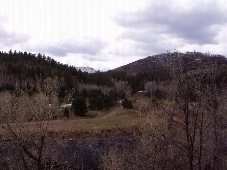
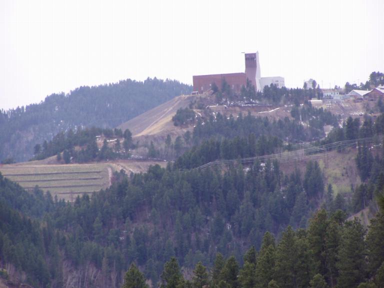
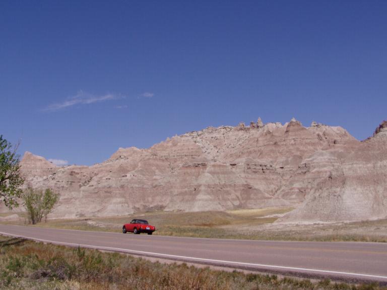
Today was a travel day, all on 2-lane county and state highways. A lot of our time was spent on scenic Nebraska Highway 2, a road Charles Kuralt said was one of the prettiest he'd driven. He was correct. From the plains of Nebraska stretching out before us to the plains on our left and foothills on our right and then up through the foothills to the high plains and on into South Dakota, the changing scenery kept us in awe. Once in South Dakota, the high plains and edges of the Badlands were simply amazing. One time I could see the road stretching out to horizon both before and behind me, and there wasn't another vehicle in sight. We spent most of the day that way, just us and the coal trains running alongside the highway - full heading east and empty headed west.. However, if I thought the winds were bad through the southern part of Nebraska, I was wrong. I hadn't seen winds until I got close to Murdo, South Dakota. They seemed to build all day long and, I mean, I 'crabbed' forever, but across South Dakota the winds really showed themselves! When we took a break in Murdo and I asked about the wind we were told it never stopped blowing but did die down a bit after the sun went down. Now I know why people don't drive across South Dakota! By the time we stopped for the night, my shoulders were so tense I couldn't lift my arms. The RV even felt the wind as it constantly shifted out of overdrive even on level roads trying to buck the dead-on wind in its face. The RV was on a constant 10° list all day and I got the worst gas mileage of the trip so far. But, we're in the Mountain Time Zone and definitely in the West. Way back in Broken Arrow, Nebraska, we saw a sign that said "Where the West Begins", and we believe it. We drove through the Rosebud Indian Reservation just after their school let out and got the chance to see all the kids walking home or wandering around in the little town of Mission, SD. Though they may be Indians, modern culture has reached them. Young boys bounced basketballs in their oversize 'gangsta' clothes, young girls looked like tanned and black haired copies of Britany Spears, and teenage boys drove cars with rear wings and fancy wheels. Strange, comforting, sad. And as I sit at the computer and Jerri prepares a light dinner, the wind is rocking the RV like it was a toy boat on a pond! Day 12 (Thursday, 29 April): We woke up to SNOW! And cold weather! Broke out coats and gloves. However, we went ahead and did the hokey tourist thing while in Wall: we toured Wall Drugs and had breakfast there. They give free coffee and a doughnut to veterans so I took advantage of their offer. Actually, the doughnut was like a huge round cake with a hole in the middle. Jerri and I shared it after our breakfast - and everything was great, especially the bacon. Then it was on to the Ellsworth Air Force Base FAMCAMP where we plan to stay until next Tuesday. It was 39º while I was hooking up all our services, brrrrrr, and the pine trees all are covered with snow on their northern sides. I've actually turned our internal propane furnace on for the first time and it definitely hats up the RV. Today is a maintenance day where we'll get things setup, vacuum, organize, replenish our groceries, etc. Tomorrow we'll tour the museum here on base since the outlying attractions of the area don't open officially until Saturday, May 1st. Our tentative plan for the next few days is:
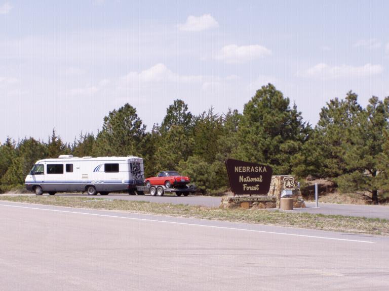
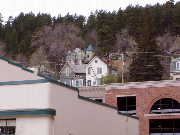
Saturday: Sturgis - Spearfish - Lead - Deadwood Loop Day 13 (Friday, 30 April): 50°, Sunny, Mild Wind. Long sleeve weather but no coat needed. It was comforting to go to bed last night to the strains of a bugle playing 'Taps'. That sound signals the end of the duty day and the time for lights out on every US military post around the world. We had become accustomed to hearing it over our career in the Army and it brought a sense of security to us as we drifted off to sleep. Luckily, we slept through 'Reveille', a bugle call at 6am signifying the beginning of the duty day. When the sun comes out in South Dakota, it comes out. The panoramic vista of the Black Hills on the horizon was breathtaking. Up here, the sun is ever so bright against an eggshell blue sky dotted with a few white, puffball clouds floating by. It was like a rebirth after the cold and windy days we had just gone through.
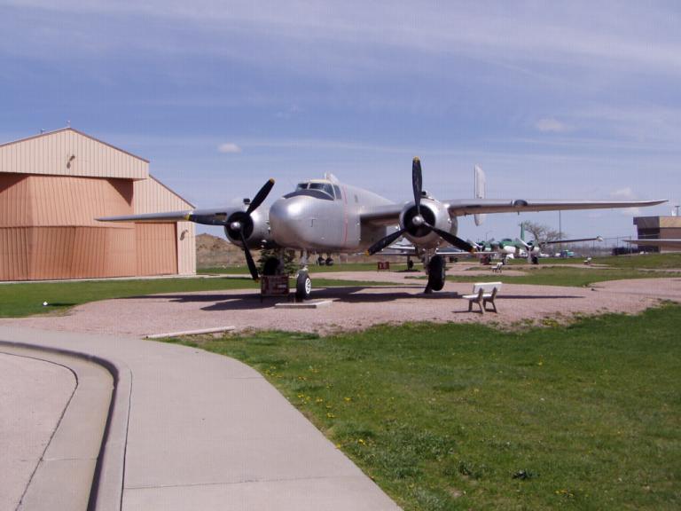
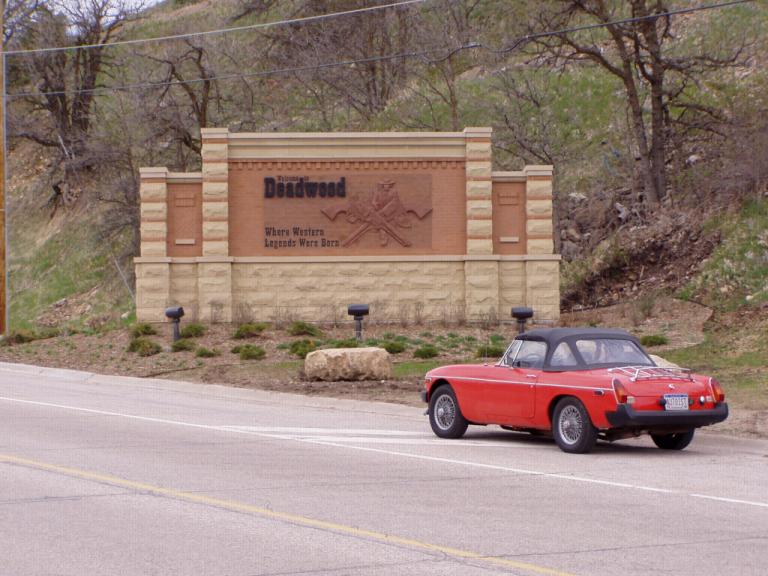
While in the museum, we kept bumping into a group of school children wandering around with clipboards and a yellow sheet of paper. They were accompanied by a group of adults who Jerri correctly assumed were their parents. Ever the consummate educator, Jerri engaged a lady - the mother of a 3rd and 5th grader - in conversation and learned they were on a field trip from a small rural school in northwest Nebraska. The school consisted of 11 students in grades K-8 (1 lone little kindergarten student) with 2 teachers, 1 for grades K-3 and the other for 4-8. Their school consists of 2 rooms, one for the lower grades and the upstairs room for the upper grades. Think of it: nobody moves away, no new people move in, if a new baby is born you can expect an increase in your class size in 5 years otherwise, you know from year-to-year who your students ill be. The yellow sheets of paper were the students' "scavenger hunt", questions they had to answer from their experience in the museum. The neat thing about the group was that they were accompanied by their mothers and fathers as well as their 2 teachers. It was definitely a group learning experience with everyone pitching in to help the students accomplish their task. One of the teachers gave Jerri a copy of their questionaire. Among the 15 questions they had to answer were questions such as: What was the B-25 aircraft on display used for during World War II? What historic event happened south of Rapid City in 1935? What was the original name of Ellsworth Air Force Base when it got its start in 1942? What were the dates of Desert Shield - Desert Storm? Name the Marine aviator who was awarded the Medal of Honor during World War II and who was also a past governor of South Dakota. In the exhibit case that has the World War II bomb pins, you can find the date of "D-Day". What is the date? With a student/teacher ratio of 11-to-2, it easy to see that the students get lots of 1-on1 personal attention. Though it was apparent that the older grades were the focus of the field trip, each older student was paired with one from the earlier grades so there was student mentoring going on as well learning. However, I was once again reminded that my life is now part of a museum and the program of instruction in schools around the country (I was in Desert Shield-Desert Storm! Those kids were studying it! And it was history to them - it even occurred before some of them were born!). Later in the day, we spent some time in the Black Visitors Hills Information Center, a veritable museum in itself with lots of information and hands-on exhibits about the Black Hills. There was an 8' x 10' map-model of the Black Hills that gave an eagle's eye view of the area with every attraction, town or point of interest marked along with the roads leading to them. There were also lots of neat exhibits about the major historical points of interest and explanations of how the Badlands came to be, among the great exhibits. Speaking with one of the interpretive history guides, I learned that our plan for visiting the Badlands/Black Hills was doable, but busy. She suggested I might want to break the Rushmore - Custer - Crazy Horse into two days because of all the other things to see in their area. I also learned that several of the roads to and inside Yellowstone are still closed because of snow! Yep, an extra day here is definitely a possibility. And somewhere tomorrow or Sunday, the odometer on our 1979 MGB will roll over to "00,000". Day 14 (Saturday, 1 May): 40's, Overcast, Mild wind. Coat weather in the Black Hills Today we drove the Sturgis - Deadwood - Spearfish Loop. The changes in the mountains and countryside are remarkable. Around every curve the vista is completely different as is the weather. We went from sun on the Plains, to mild overcast in Deadwood to snow flurries in Spearfish Canyon. Overall, today was a great day. Here's how it went: Sturgis: I had to stop by Sturgis just because I like my Norton motorcycle and every August its a Mecca for riders, 300,000 last year to be exact. But, other times of the year, its dead; and today was one of those days. However, since we were there anyway, we wandered down Main Street and bought the obligatory black 'Sturgis Motorcycle Rally' tee shirt. Deadwood: Now, that was a little town we definitely enjoyed. As we climbed into the Black Hills from Sturgis, the countryside changed drastically. Before long, we were into evergreen trees and among them stands of white Birches, trees that remind Jerri of Alaska. And before we knew it, we'd stepped back in time to the Deadwood of the 1800's.
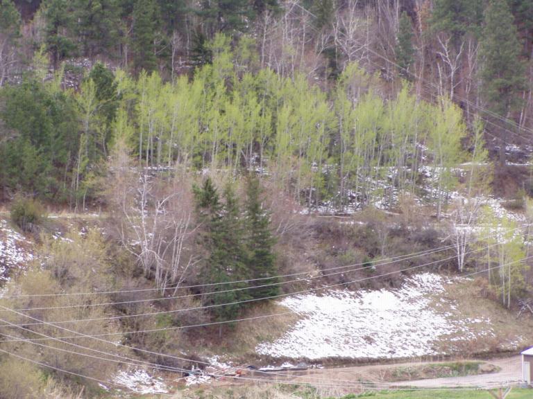
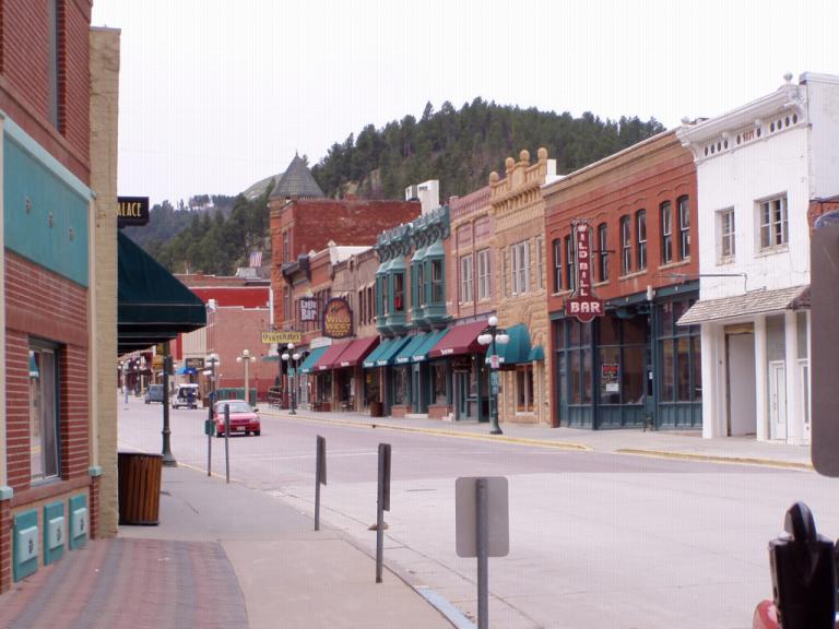
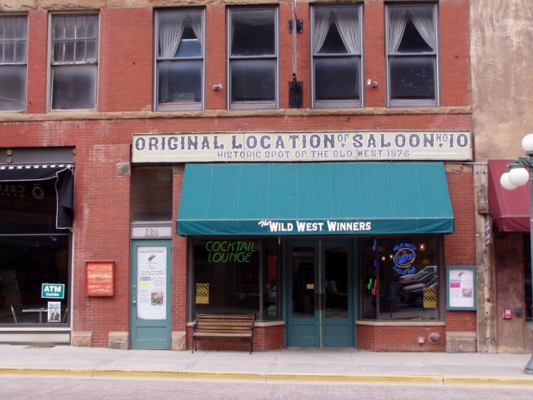
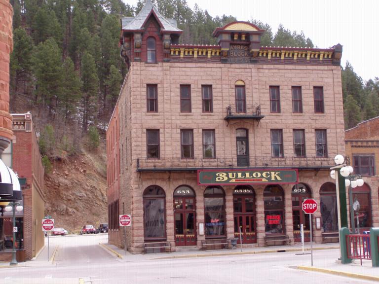
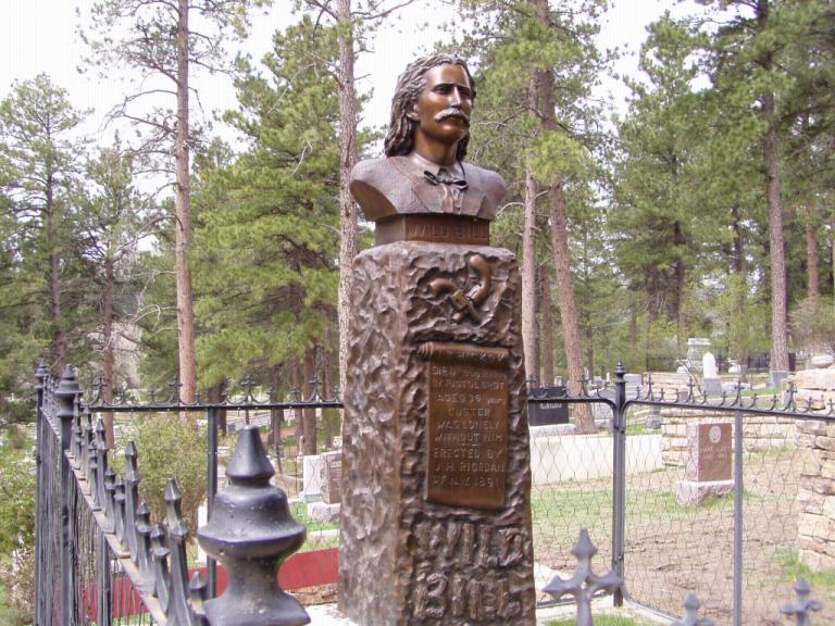
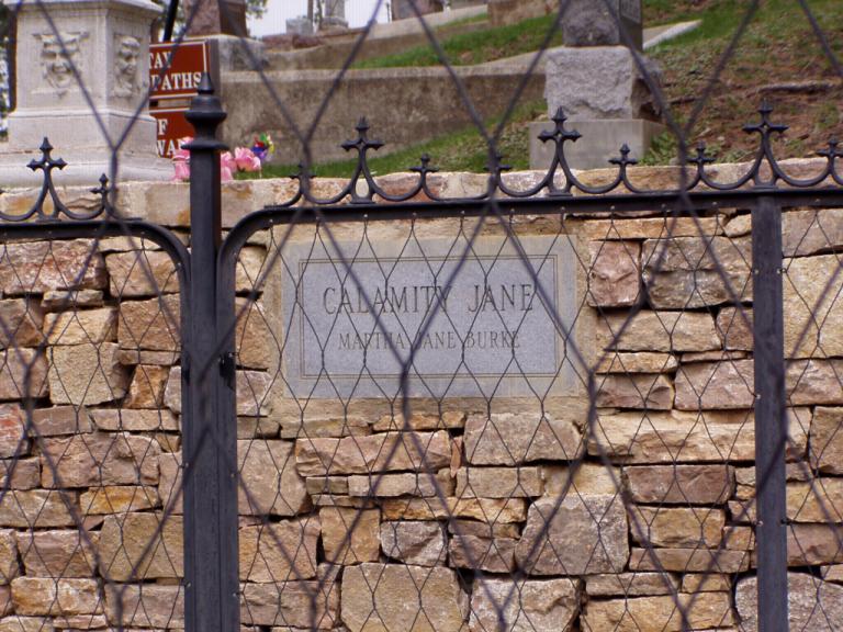
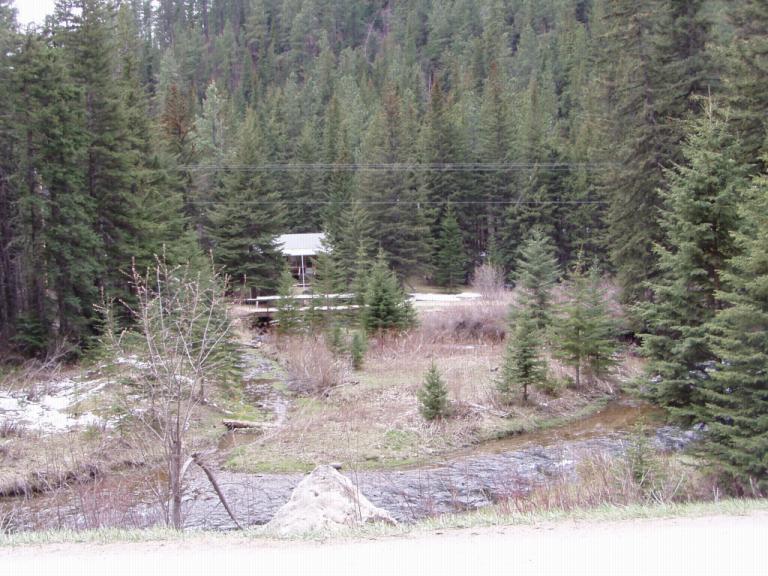
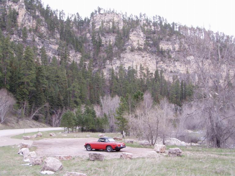
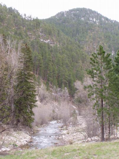
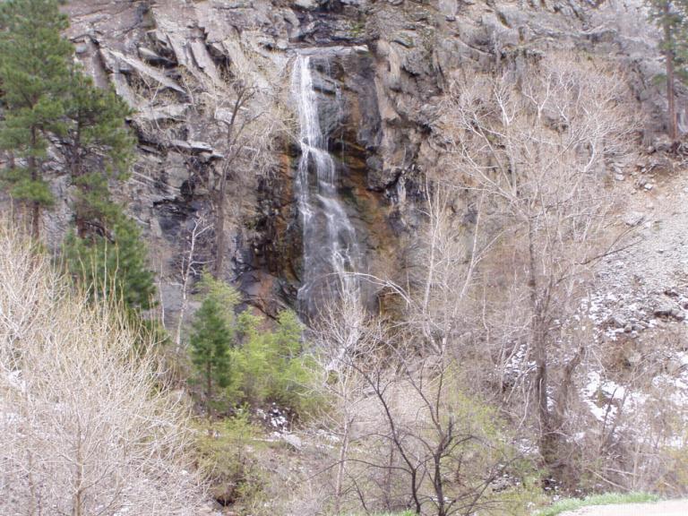
What with the popularity of the new HBO series, Deadwood, I think its important to set Deadwood's story straight. Deadwood was established in 1876 during the Black Hills gold rush. About the time it was established, in June 1876, "Wild Bill" Hickok (James Butler Hickok) wandered into town ostensibly to prospect for gold, but actually to gamble. Wild Bill, a friend of General George Armstrong Custer and Buffalo Bill Cody, had earlier gained fame as the marshal who cleaned up Abilene, Kansas and was known as one of the West's first so-called 'fast guns'. On August 2, 1876, he was shot in the back by Jack McCall during a card game in Deadwood's No. 10 Saloon. Wild Bill's habit had always been to sit with his back to the wall, but for some reason that day he sat with his back to the room. The actual chair in which Wild Bill was sitting when he was shot is on display in the No. 10 Saloon which today has been rebuilt to replicate the saloon on the day when he was shot. Nobody knows exactly where the original saloon was located as Deadwood has burned to the ground 3 times but there's a building that's as close to the original saloon as is possible. I spent some time talking with the bartender and learned that the chair is insured with Lloyds of London for $100,000 and that Wild Bill's guns are in a museum in Cody, Wyoming. I was amazed that the chair had been saved and could be documented. According to the bartender, the story goes that Calamity Jane (Martha Canary) took the chair to Terry, SD where it remained until she died in 1903. Wild Bill, his friend Charley Utter, and Calamity Jane had all arrived in Deadwood at the same time. Charley and Wild Bill were friends. Calamity Jane and Wild Bill had only met a few times yet after his death she claimed to have been Wild Bill's sweetheart; and, right before her death, she asked to be buried next to him. She is. Charlie Utter remained in Deadwood after Wild Bill's death and became prosperous through several business interests. In fact, Utter Place is still in business as a restaurant and casino. In the HBO series, Seth Bullock, an ex-lawman, came to Deadwood about the same time as Wild Bill to open a hardware store. That part of the series is correct; however, later he built and operated the Bullock Hotel. The itinerant minister in the series is "Preacher Smith", Henry Weston Smith, an ordained Methodist minister and a medical doctor who worked at menial jobs during the week and preached on Sundays. On Sunday, August 20, 1876 - 18 days after Wild Bill was murdered - Preacher Smith was killed by Indians. His death apparently caused more commotion in Deadwood than did Wild Bill's. Oh, Jack McCall the man who who murdered Wild Bill? A kangaroo court in Deadwood found him innocent because Wild Bill had earlier killed his brother. However, he was later hanged for the murder after a real jury in Yankton found him guilty. Its interesting that Deadwood, a town that's been around for over 125 years, ties its entire history to the murder of a man who was only in town for a couple of months! And the HBO series apparently is following the history of Deadwood pretty closely. Jerri and I both really liked Deadwood. Though a tourist town, it feels more real than towns like Gatlinburg, TN. Oh, its the only place in South Dakota where gambling is legal. And I do like eating in casinos! Today I had a juicy, tender 12 ounce ribeye steak cooked exactly right (medium rare), mashed potatoes and gravy, Texas bread and a salad for $3.99. Jerri had a salad, soup and a sandwich for $2.99. Casinos always have great, cheap food, be they in Las Vegas, Reno or Deadwood; and we recommend Tin Lizzie's Casino for its lunch. Yes, I did drop a few quarters in their slots. No, I didn't win. Along the Spearfish Canyon Scenic Byway (US 14A): From Deadwood we drove up US 14A through the little town of Lead, SD over Terry Peak (EL 7604) to Savoy, SD. From there, we turned onto the Spearfish Canyon Scenic Byway. Man, I wish the weather had permitted top down driving because the scenery was absolutely superb; however, as we drove through the canyon we ran through snow flurries. The photos tell the story better than I could:
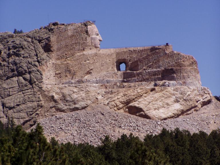
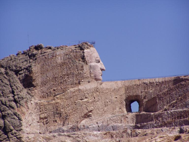
Day 15 (Sunday, 2 May): 60's, Slightly Overcast to Sunny. Long Sleeves. Today was the Crazy Horse - Custer - Mount Rushmore Loop; and I would suggest that's the way they should be viewed, in a counterclockwise loop that's made for some great driving. More to come on that later. Crazy Horse: In 1939, Chief Henry Standing Bear an elder of the Ogallala Lakota Tribe invited Korczak Ziolkowski to carve Crazy Horse's image into the Black Hills. Work has continued since then to get the monument to the point it is today (and, under the auspices of Korczak's wife, 4 daughters and 3 sons, work continues today). Crazy Horse was one of the tacticians who planned and carried out the massacre of the 7th Calvary at Little Big Horn. The monument remembers Crazy Horse's response in later years after the White Man had conquered the Black Hills when asked, "Where are your lands now?" Crazy Horse pointed and replied, "My lands are where my dead lie buried." When (and 'if'') its completed, it will be the largest sculpted portrait in the world. As an example of its enormity, the portrait of the 4 presidents at Mount Rushmore (60' tall) fits within Crazy Horse's head (87' tall)! Overall, the portrait will be 563' high, 641' long and carved in-the-round. 1939 until today:
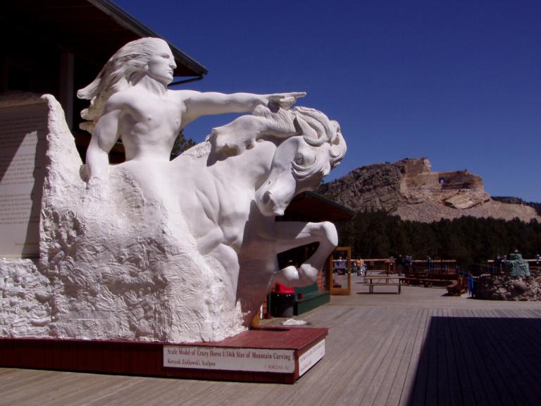
And a view of the work to date as a backdrop for the original model of the finished portrait:
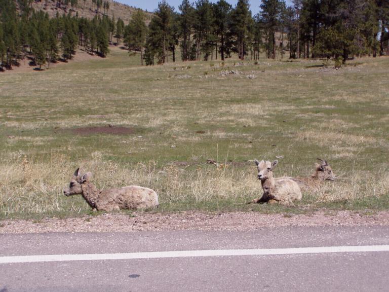
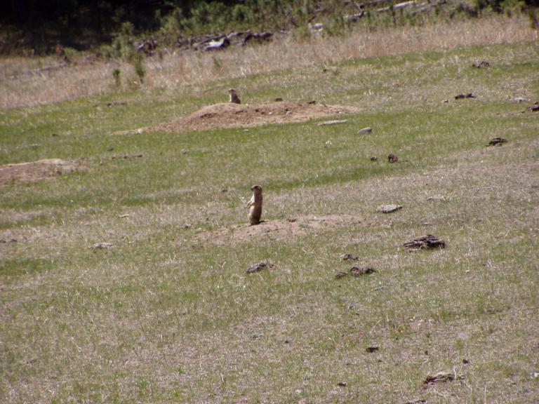
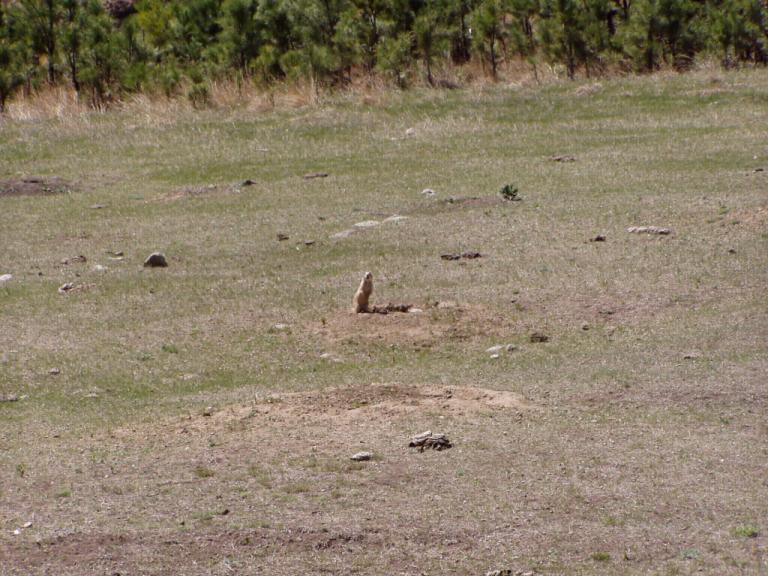
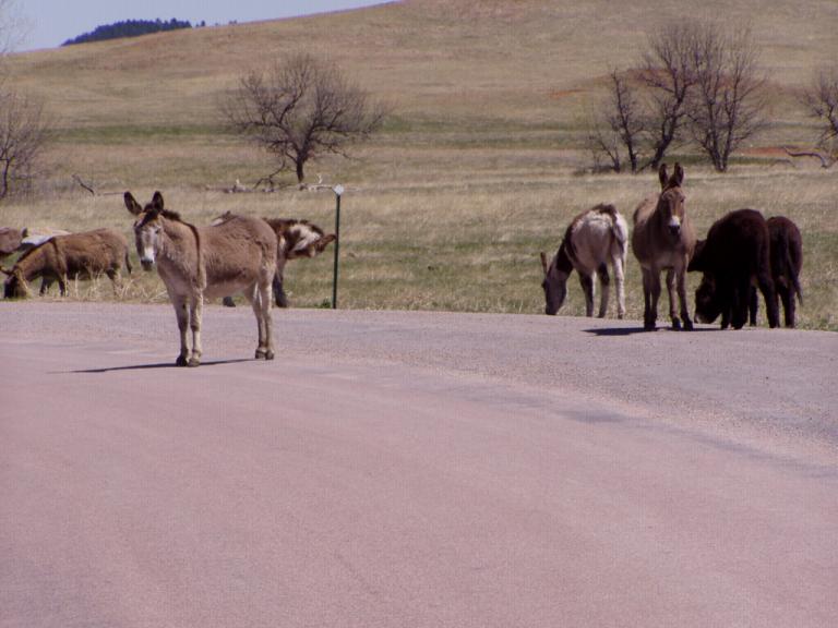
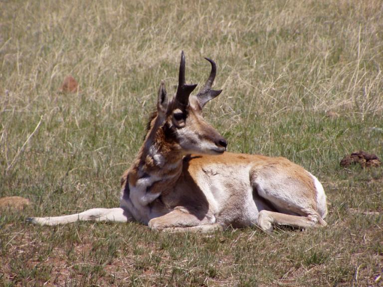
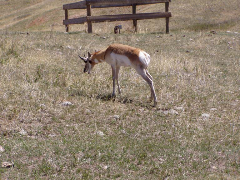
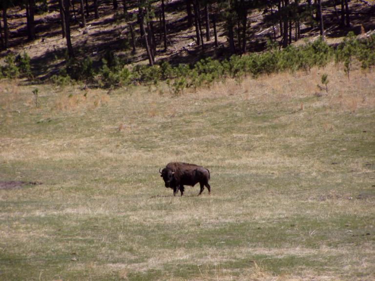
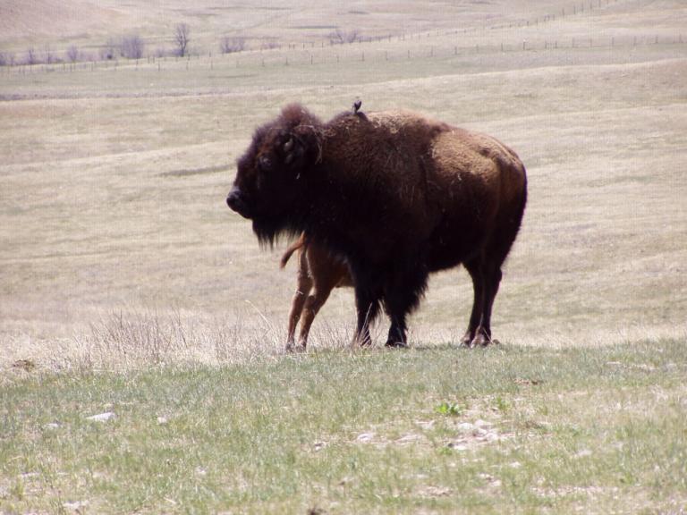
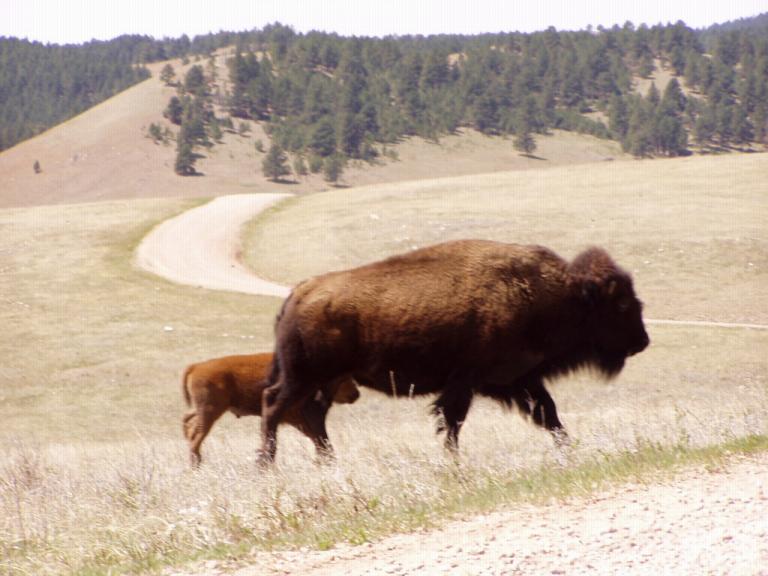
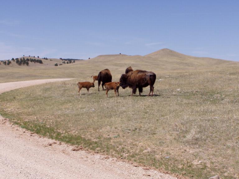
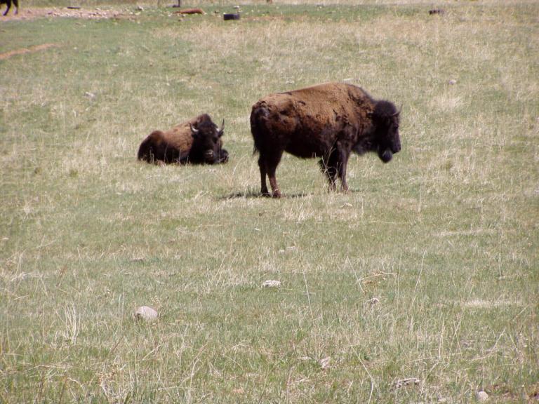
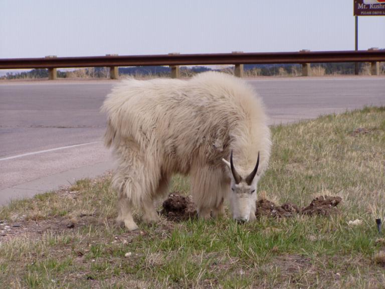
Custer, South Dakota is named after General George Armstrong Custer who came through the area on his was to the Black hills. It was a member of his expedition who first discovered gold in French Creek, right outside present-day Custer. However, Custer State Park is the real attraction of the area. Custer State Park: There are 3 reasons we enjoyed Custer State Park: scenery, animals, and roads. The scenery changed from grassy, rolling hills to high mountains full of pines to valleys of White Birch. The animals? Well, here are examples:
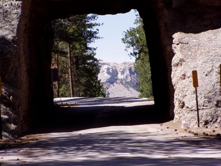
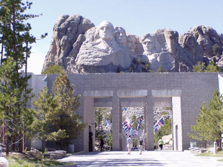
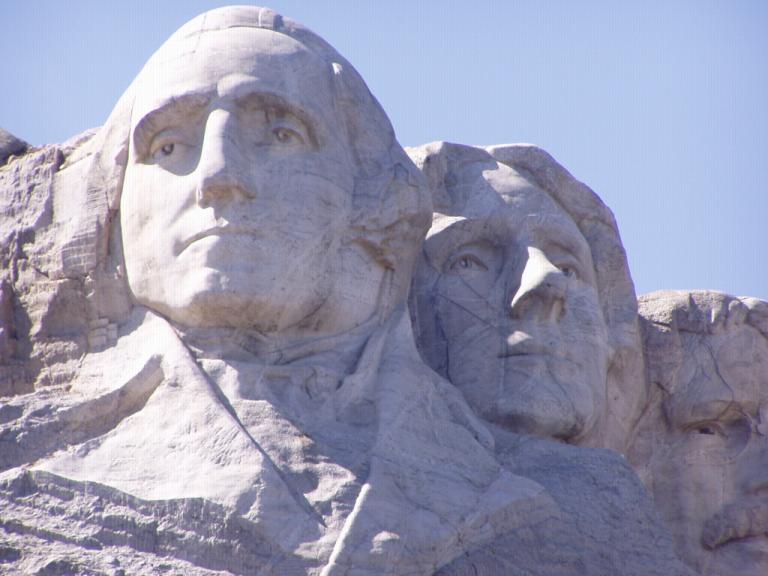
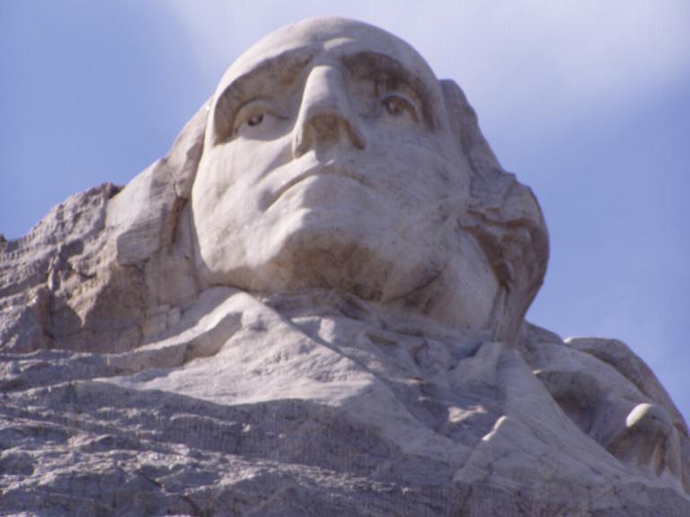
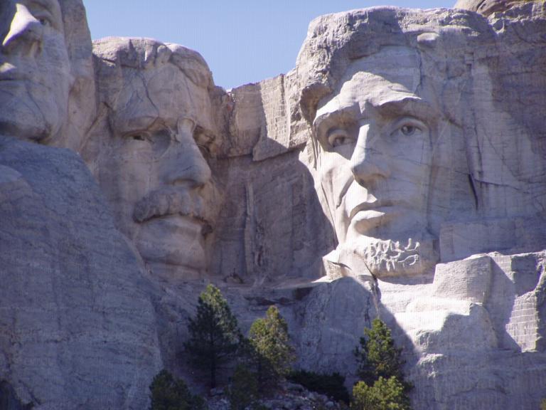
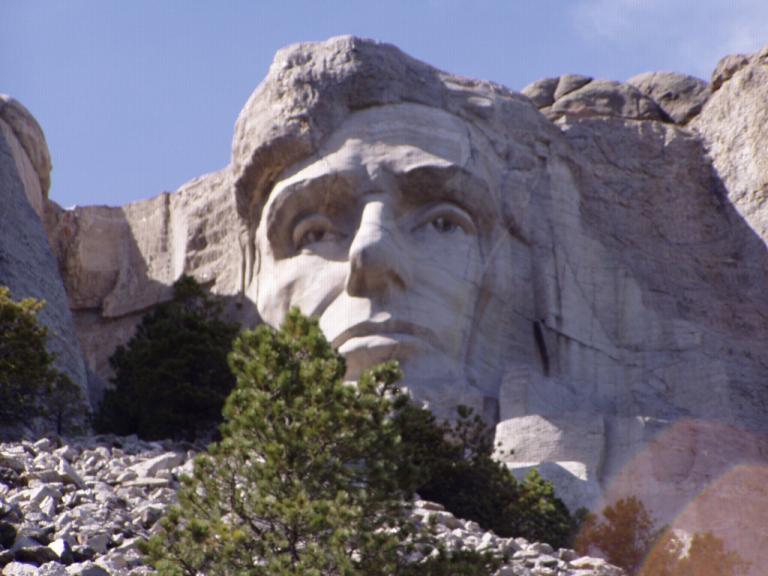
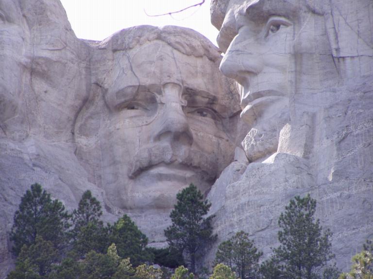
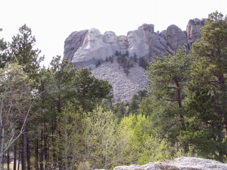
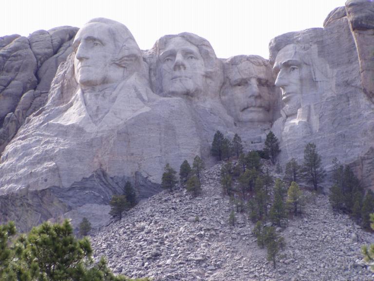
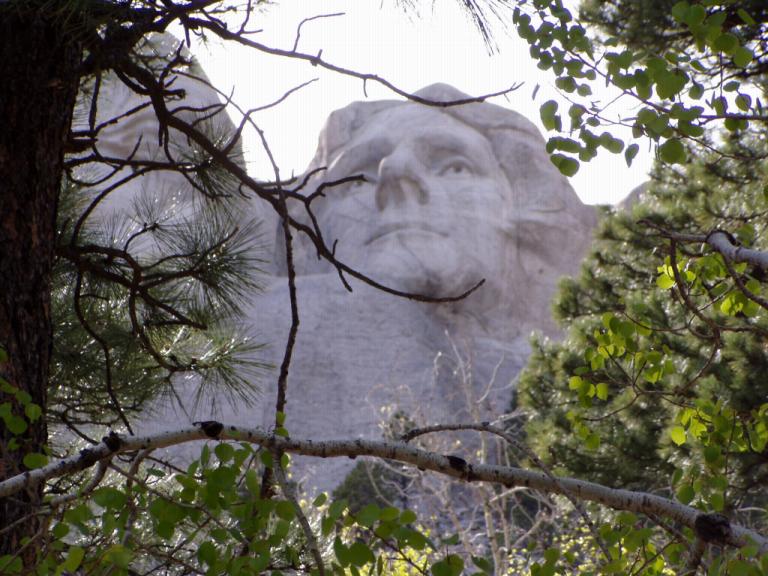
Mount Rushmore: What was to be the highlight of the day actually had to compete with everything we'd already seen. We were getting ready to be let down. However, that was not to be the case. Mount Rushmore is actually a great tour. The idea for the monument came to Doane Robinson the South Dakota historian in 1923. Gutzon Borglum was hired to do the carving. Borglum wanted the monument be a symbol for the ideas of freedom and democracy on which the US was founded. He chose Presidents Washington (birth of our Nation), Jefferson (growth of the Nation), Lincoln (preservation of the Nation), and Theodore Roosevelt (development of the Nation).
By the time we'd gotten back to the RV, we'd covered almost 150 miles and the MG had rolled over to '00000' on its odometer! And it was time for the Soprano's and Deadwood on HBO. You know, I remember the first TV I ever saw. It was a huge wooden box console, probably 4-feet in length and as many high sitting in my grandfather's living room. The screen of that TV, however, was probably only 8 or 10 inches across diagonally. The rest of that huge case was loaded with tubes and other ancient mechanisms needed to make that black and white picture glow. Tonight, I'm sitting in my RV in South Dakota, my tiny satellite dish locked onto a satellite miles above the earth, watching TV programs that are beamed from a studio somewhere across the country to that satellite and then downloaded to my TV. Maybe my life really is in a museum! Day 16 (Monday, 3 May): 70's, Sunny & Windy, Short sleeves. Today was the Badlands National Park. Early this morning, we drove out US 44 south of the park along the Pine Ridge Indian Reservation through the Buffalo Gap National Grasslands about 65 miles until we came to the little Indian town of Interior (Pop: 67) where we stopped for an early lunch. Our waitress explained that she was a Sioux and that Ogallala Lakota and Sioux were the same thing. She recommended I try the Sioux Indian Taco which is made using buffalo meat; and, boy, she was right on! It was so good, I asked for a recipe, something Jerri usually does. Here it is; oh, the recipe makes about 4 but they're HUGE!
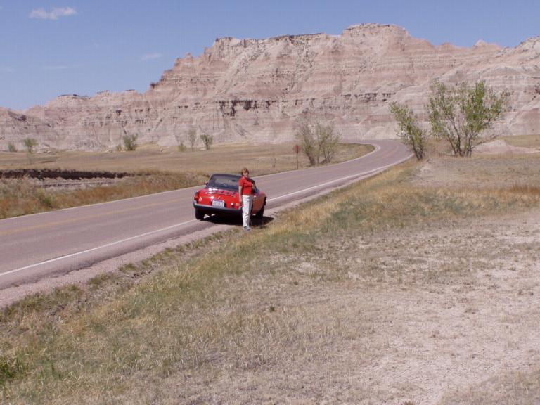
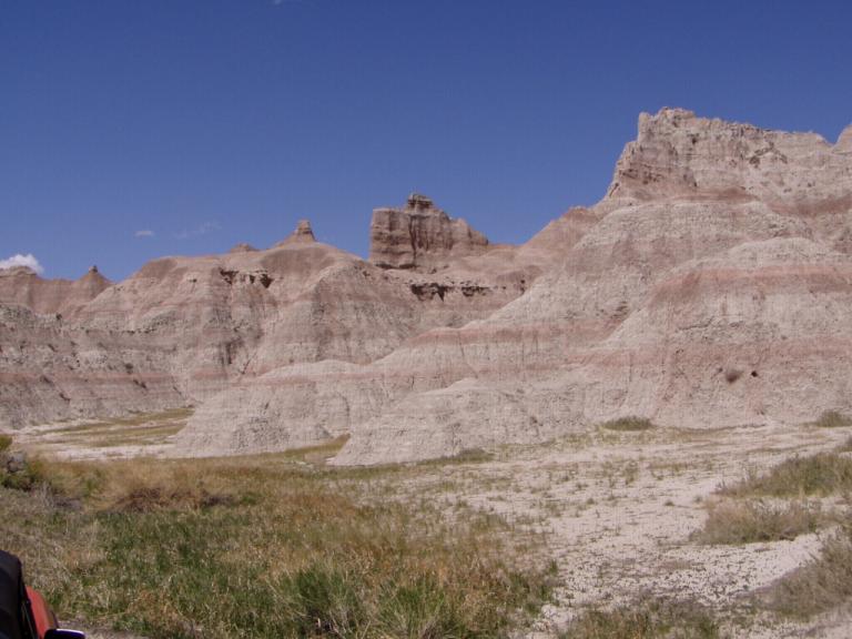
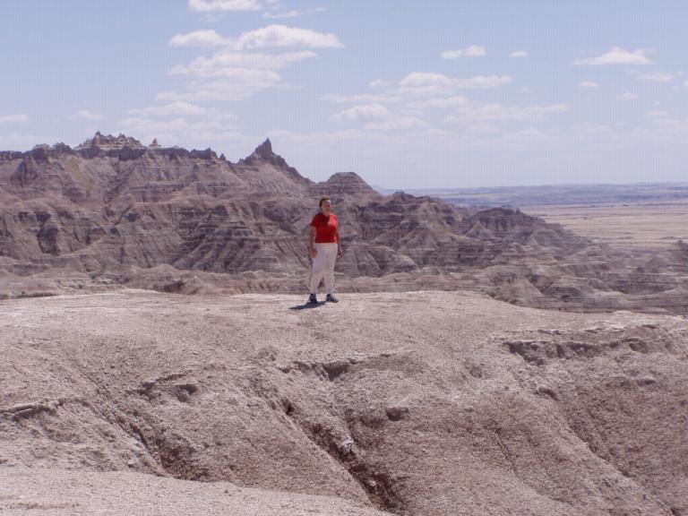
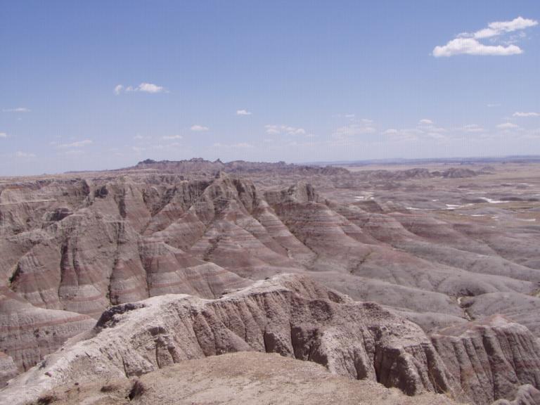
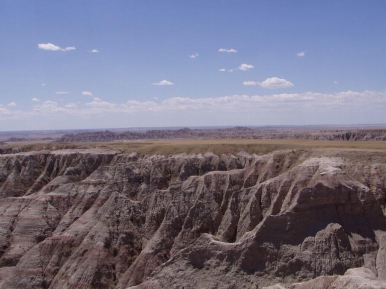
When we entered the Badlands National Park, it was like going to another planet. I can imagine the science fiction movies that could be filmed there. Until we climbed on top of the buttes, there was no wind; however, once we'd driven through the upper passes, it was blowing about 20 mph!
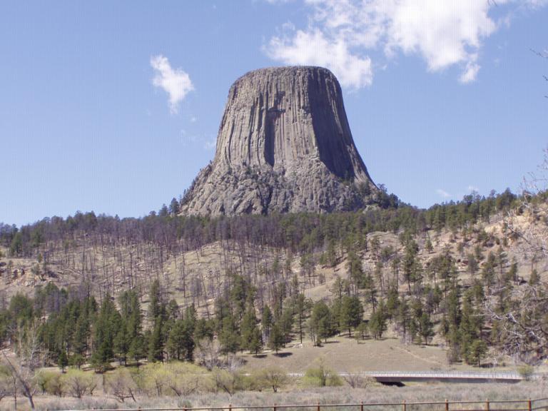
The 3 loop drives we made over the last 3 days were each between 150 and 200 miles (about 5 gallons of gas each day for the little MG), and they were just about perfect in length. The Crazy Horse - Custer State Park - Mount Rushmore loop was the longest because we got so involved with everything along the way; however, we both agreed it was our favorite day, second to the Sturgis - Deadwood - Spearfish loop. While this is a uniquely beautiful area with so many different landscapes, we both agreed its a nice place to visit but not to live. How does anybody ever get accustomed to that ever blowing wind? Day 17 (Tuesday, 4 May): 80's. Sunny. Shorts Weather! Today was a travel day. Our main goal was to see Devil's Tower National Monument; everything after that was 'gravy'. After restocking the pantry at Ellsworth's commissary and refilling our propane tank, we headed west with the morning sun via SD34 to Belle Fourche, SD. Actually, we didn't need to refill the propane tank as we'd only used 5 gallons since home; but, I didn't trust my gauges. My plan is to stay off interstates where I can and, in doing so, we unknowingly retraced both Lewis & Clark's and the Custer Expedition's footsteps. From Belle Fourche, we contined westward until SD34 turned into WY24. Both roads were great, WY24 a bit better, and both were pretty flat. All-in-all, it was a pleasant morning drive.
I learned several things while driving across Wyoming today: § There are more Pronghorn Antelope in Wyoming than residents. At one point on US14 near Keyhole State Park, we ran into a herd of several hundred and had to wait and blow our horn until they got off the road. § Gillette, WY produces about 1/3rd of the coal America consumes. All those long coal-laden trains that slowly rumble through Gurley en route to Scottsboro started their journey there. We saw the gaping holes the coal mines cut through the high prairie throughout Campbell County, WY. However, they do an amazing job or soil recovery when a particular area is mined out. Its also a major oil and gas producing area and is known as the "energy capital of the Nation". We saw several fields where they were either drilling for oil or gas - multiple drilling sites. § There's absolutely NOTHING between Gillette and Buffalo, WY! 67 miles of barren high plain country. And somewhere between those two cities we saw our first snow capped mountains, the Bighorn Mountains. At first we both thought they were low hanging clouds that produced quite a shaded area underneath them as with the sun shining directly in our faces, we were barely able to recognize them as mountains. But the closer we got to Buffalo, the larger and more clear they became. And at this point, we've left the Black hills behind us and are in the void between them and the Bighorn Mountains.
|
||||||||||||||||||||||||||||||||||||||||||||||||||||||||||||||||||||||||||||||||||||||||||||||||||||||||||||||||||||||||||||||||||||

