|
To Yellowstone & Beyond |
Day 18 (Wednesday, 5 May): 80's, Sunny, Shorts, Top Down Day
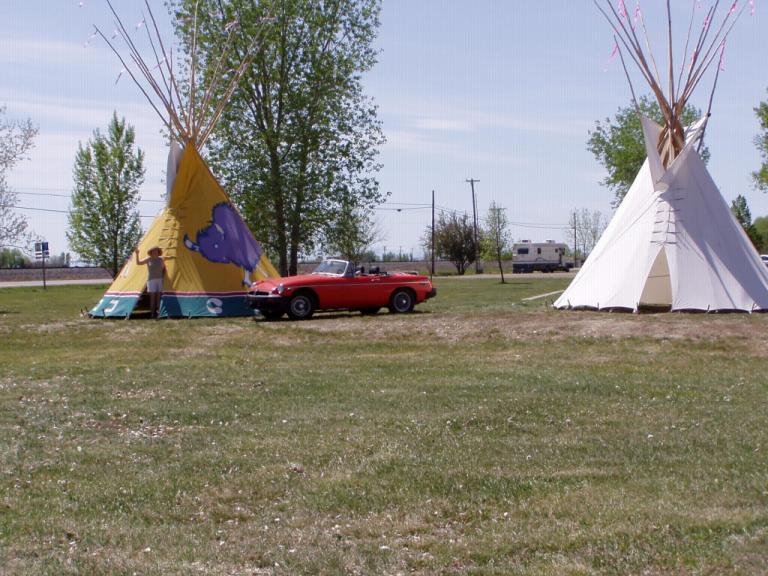
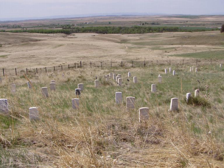
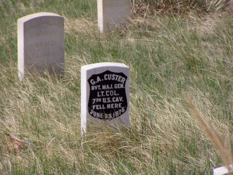
Today, we spent part of the afternoon in the Bighorn County Museum, an excellent cluster of 1800's and early 1900's buildings that depict life in the general area during those times. Also located on the grounds is the Campbell Farming Corporation Camp 4. Thomas D. Campbell got President Woodrow Wilson to lease him 7,000 acres of land of Indian lands so he could raise wheat on a large scale using mechanized farming ideas of his. He got J. P. Morgan, Jr. and a group of New York bankers to finance his venture, and by 1922 his Campbell Farming Corporation was the world's largest privately owned wheat farm, all 10,000 acres. Camp 4 is the camp where some of his 100 laborers lived. It consists of an office/commissary, cookhouse, bunkhouse, and shower house; a pretty spartan existence but some interesting history. There are photos of General Campbell in his Stutz Bearcat sports car overseeing a line 13 of huge 30-60 Autman Taylor tractors plowing unbroken sod of the Crow Reservation. Afterwards, we drove out to the Little Bighorn National Park to tour the museum and see the film about the battle. Tomorrow we'll do the battlefield tour as the museum took about 2 hours to go through and I really want to study the battlefield. George Armstrong Custer has always been an enigma to me. Was he a brilliant cavalryman or lucky buffoon? His exploits during the War Between the States support the first; his escapades after the war in Texas, the Dakota's and Montana support the latter. IMHO (in my humble opinion), he wasn't much of an officer. He continually disobeyed orders and was even found guilty by court martial (neglect of duty & conduct to the prejudice of good order and military discipline" were the charges) before he ever received his first set or orders upon graduation from West Point. He cared nothing about the well being of his men, and, again IMHO, was the proverbial bumbling idiot who could fall into a pig sty and come out smelling like a rose (see how nicely I put that!). Day 19 (Thursday, 6 May): 80's, Sunny, Shorts, Top Down Day. Well, we spent the day walking the battlefield from where Custer first spied Sitting Bull's camp some 15 miles away all the way to "Last Stand Hill". Here's my take: Custer graduated from West Point in 1861, last in his class. On June 26, 1876, believing his own press that he was the best cavalryman ever, he ended his 15 year military career by committing suicide, taking the 7th Cavalry with him! Disobeying orders to scout the area and await General Terry's follow-on column, Custer decided to attack Sitting Bull without a commander's reconnaissance to ascertain the size of the force he was facing. Using a tactic that had proven successful in the past, he split his unit ordering Major Reno and his forces to attack the village from the south while he went farther north behind the protection of a ridge to find the north end of the camp. About halfway up the ridge, he again split his remaining forces sending Captain Myles Keough and those with him to attack the middle of the camp while he and his forces continued northward behind the protection of the ridge. Had everything worked according to plan, they were all to meet again in the camp - after Reno and Keough had it pretty much under control - for Custer to finish the job. However, Custer was soon to meet the best light cavalryman in the Nation, Crazy Horse. Reno ran into heavy resistance when he attacked the camp and had to fall back into a defensive position. In my study of it, I found a textbook position that was set up in such a way that Reno could hold off the enemy until reinforced. It was also 5 miles south of where Custer was locked in battle; however, from a high point, Custer had watched Reno's initial action so knew of his circumstances before he himself became engaged. My question: why didn't Custer return to help Reno?
After Custer left Reno to attack the village, he rode northward behind a prevailing ridge until he came to a place where he could see the Indian camp. At that point, he called for Captain Benteen and his battalion to reinforce his command though he had not yet faced the enemy himself. Benteen was quickly repulsed and, after fighting a defensive battle, joined Reno to the south where he helped hold off the Indians until General terry arrived. As Keough approached the village, Crazy horse launched an attack on his party, splitting them, stampeding their horses, and generally (IMHO) causing Keough's command structure to crumble. It was then pretty much ever man for himself as they tried to outrun Crazy Horse and his warriors in an attempt to regroup with Custer. However, Custer was himself locked in fierce battle as he also tried to outrun Crazy Horse's warriors. Finally, at a point called Last Stand Hill, Custer and his group, including some of Keough's men, dismounted, shot their horses and made a last, dying stand.
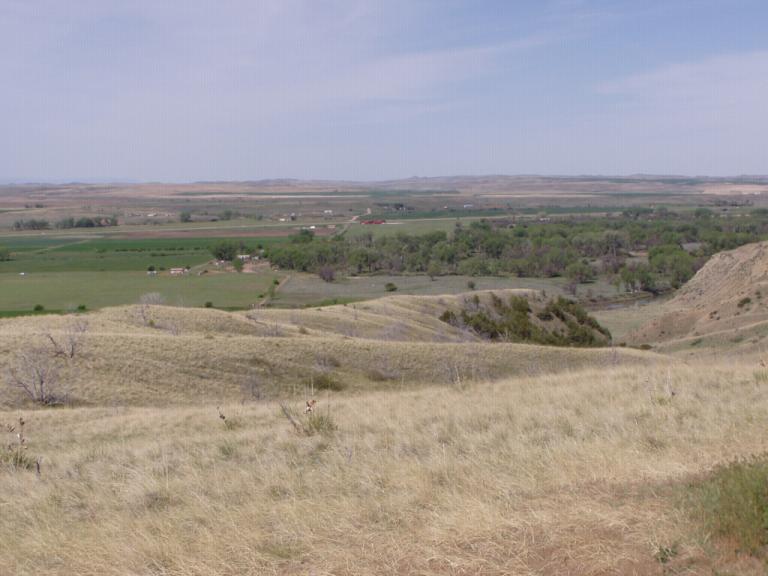
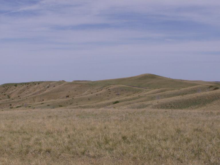
Its pretty evident by the way the markers are set that Custer's command was in a rout, they were retreating from the enemy as fast as they could. What one doesn't see until walking the battlefield is the area around Last Stand Hill. There are markers to one side where it appears a group of Captain Myles Keogh's men were killed as they tried to join Custer on Last Stand Hill. To another side are a couple of markers of soldiers who died trying to escape northward from Last Stand Hill. All-in-all, it appears that when Custer realized he had bit off more than he could handle, instead of trying to regroup with Reno, he ran towards where he expected General Terry's column to soon be, leaving Reno and his men to their own fate. Major Reno had the foresight to establish a defensive position to try and save his unit. Captain Benteen fell back to Reno and, together, they were able to fend off the Indians until Terry arrived 2 days later. Captain Keough, when he faced overwhelming forces, tried to make it to Custer's position but he and his forces were cut down. Custer and a small band of some 40 soldiers were running for their lives when Crazy Horse and his cavalrymen finally overran them. Honor? Dignity? No, IMHO, Little Bighorn was the last hurrah of a man who believed in only himself and sought every opportunity to make himself look the hero. Had he obeyed his orders to scout the area and await General Terry's column, their combined forces could've turned the tide in the opposite direction; but, Custer was out for Custer! In the end, the Indians won. The battlefield is on the Crow reservation so they kept their land. Every Park Ranger and employee was an Indian. Right outside the park, in view of the National Battlefield, is an Indian casino, tourist shopping areas and a KFC - all run by Indians. About the only good thing that came out of Little Bighorn was that the Army started survivor benefit insurance as a result of it. Until then, members of a unit in which a man died took up a collection to help to family, if there was one, get back home. After Little bighorn when every member of the unit was killed, there was nobody to help the widows and orphans. We also spent some time exploring the reservation. In the little town of Crow Agency, we found the tribal government buildings clustered underneath a grove of cottonwoods. In the hamlet of Garyowen we found a great little museum and general store where we sat under a canopy of cottonwoods listening to loudspeakers retell the story of Little Bighorn from the Indians' perspective. Something unusual we noticed was that behind many of the small, rectangular, government-provided houses in both towns and the surrounding reservation area were authenticate teepee poles leaning against trees awaiting construction during the annual pow-wow. As an aside, every time she sees a school bus, Jerri points it out as if I didn't see it. Out west, we see lots of 'short buses', the type primarily set up for the needs of special students back home. Here, they are marked "Crow Head Start" or some other Indian agency Head Start program. They're zipping along everywhere taking their small charges to their morning classes, home for lunch or taking their afternoon charges to their afternoon classes. Plus, we're seeing lots of 'long buses' throughout the day, taking classes of students on field trips. (We were even joined on our tour of the battlefield today by a couple of bus loads of middle school-aged kids - under the control of park rangers, thank goodness!) Day 20 (Friday, 7 May): 80's, Sunny, Shorts Day. I really like my Delorme GPS! Most of the time I plot my routes using my AAA Map'n'Go 7.0 software; occasionally, I use my Delorme Street Atlas USA 2003 software. I've permanently entered my preferences for roads, primarily staying off interstates and choosing scenic roads where possible; so, the night before a travel day, I just tell my computer where I am and where I want to go. Then, while traveling, I allow the voice from my computer to tell me where to turn. I would've never come over some of the routes I have so far without it; and, its turned out to be the best way to really see the country. This morning, we left Hardin, MT, ran the interstate up to Billings, MT (the only way) and then got off on 2-lane US and Montana/Wyoming highways to Cody, Wyoming. Our route took us through the Yellowstone River valley right along the banks of the swiftly moving river. That valley is an absolutely fabulously fertile farming region with its unique irrigation systems fed from the river. Along that route, we also got our first glimpses of the snow covered Rocky Mountains via the Absaroke Range which is just north of Yellowstone National Park. Then, when we got into Wyoming, my GPS directed us to turn in the opposite direction of where the signs said we should be going to get to Cody (ya gotta trust your GPS I learned in Saudi Arabia and Iraq!). Going that direction took us up through a high plains desert. Jerri said those mountains reminded her of the Badlands except much more bare. I mean, we were up in Alpine country! And then suddenly we were in a fertile high plains valley resplendent with wheat fields as far as the eye could see, each with its own irrigation canals soaking the furrows of newly planted wheat. Beautiful is all we could say. After just a few hours drive, we arrived in Cody, the most beautiful place we've seen so far. Clean, neat, affluent, this little town definitely is worth the visit. When we went through Sheridan, WY a few days ago, we were only 148 miles from Cody but the road was hilly and curvy. Plus, I wanted to jot up to Hardin to see Little Bighorn. The drive today was a little over 160 miles but was pretty flat and without too many curves. I've kept my cruise control set on 55mph all across the country, and today was no exception even though I was on 2-lane state highways the majority of the time.
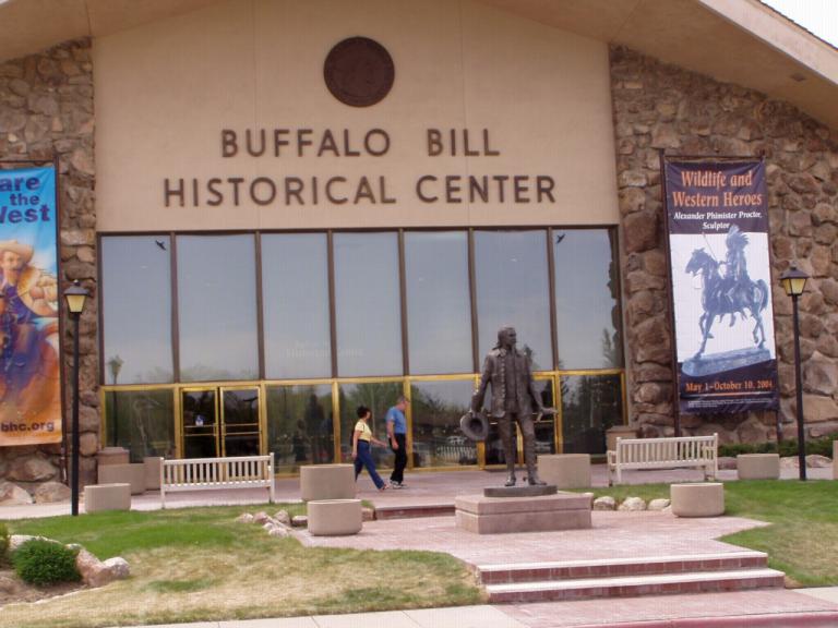
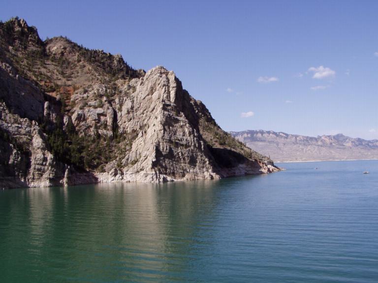
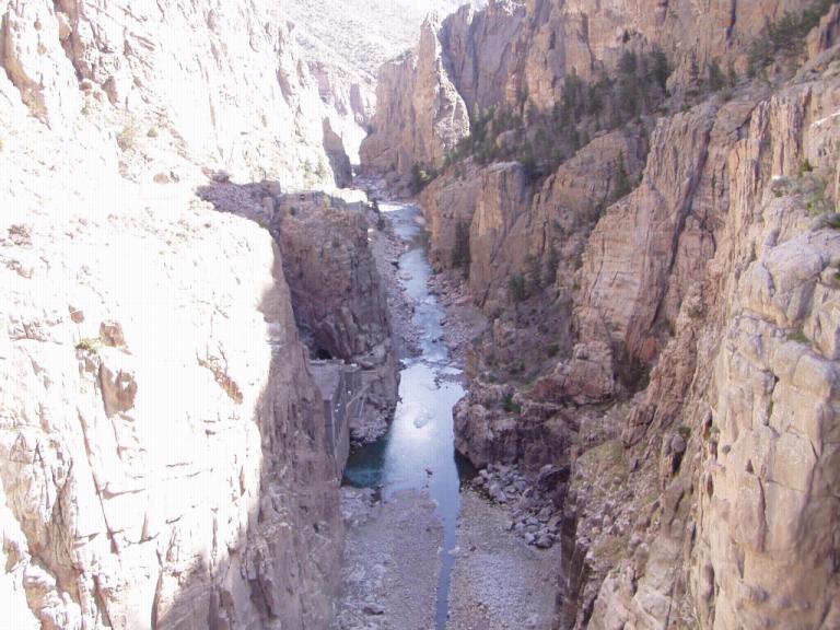
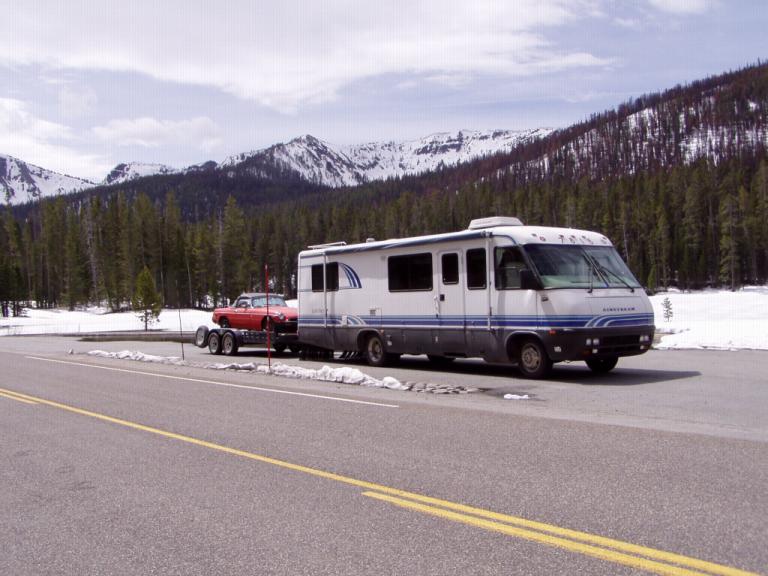
Actually, the Buffalo Bill Historical Center is 5 museums in one: the Draper Museum of Natural History is an interactive trail through the sights and sounds of the Yellowstone area; the Buffalo Bill Museum tells the private and public life of Buffalo Bill, to include real history and myth; the Plains Indian Museum has one of the country's finest collections of Indian art and artifacts; the Whitney Gallery of western Art and Kriendler Gallery has the best collection of Remington's I've ever seen in one place not to mention all the other great art; and the Cody Firearms Museum is the world's largest assemblage of American arms dating back to the 16th century, 5,000+ firearms to include several of Buffalo Bill's, Wild Bill Hickok's pistols, Annie Oakley's rifles plus pistols used in most of the westerns I saw on TV (Gunsmoke, Paladin, Bonanza) as a child and young man plus weapons from every major American manufacturer. And the best RV park we've stayed in yet: Ponderosa Campground, 1815 8th Street, P.O. Box 1477, Cody, WY 82414, TEL: 307.587.8461, email: codyrvparks@wavecom.net. Day 21 (Saturday, 8 May): 80's, Sunny, Shorts Day (until we got up in the snow of the Rockies!). Up early today as the excitement of getting to Yellowstone had set in. We pulled out for the long haul from Cody, WY (EL. 5016 ft) to the east entrance of Yellowstone (EL. 10,000 ft). I've gotta give credit to Gale Banks for the great 'Banks Power' setup we installed on the RV before leaving. There's been another Airstream RV around us in Rapid city, Hardin, and Cody. Speaking with him last night, he's getting 7mpg and the mountains are doing his rig in - and he's not towing anything. I'm getting 11mpg towing my MG on a trailer and the mountains haven't affected us yet. wonder what he thought about the mountains in and around Yellowstone. They didn't affect us much but we did get out of 'overdrive' into 'drive' most of the day. And we were able to maintain the speed limit thus we weren't holdng anybody back except the idiots in their SUV's who wanted to speed from one attraction to the next, disregarding anything in between.
Before we knew it, we were up in the snow of the Rockies, entering Yellowstone from the east entrance.
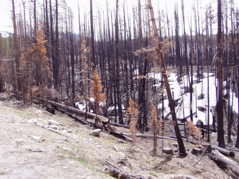
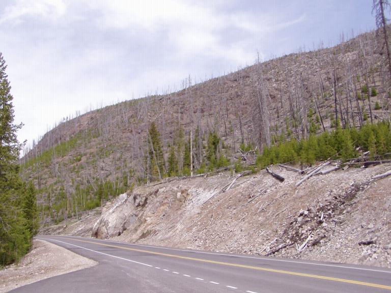
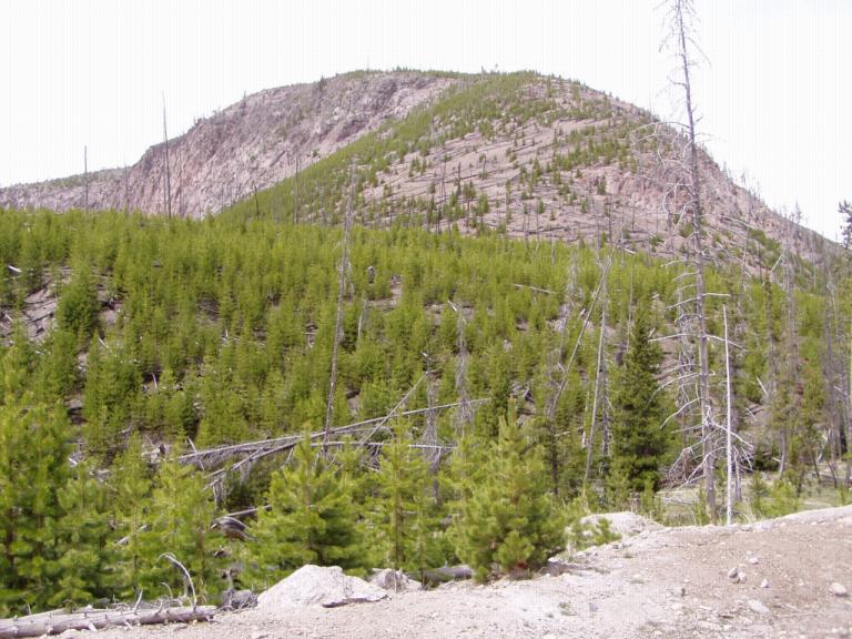
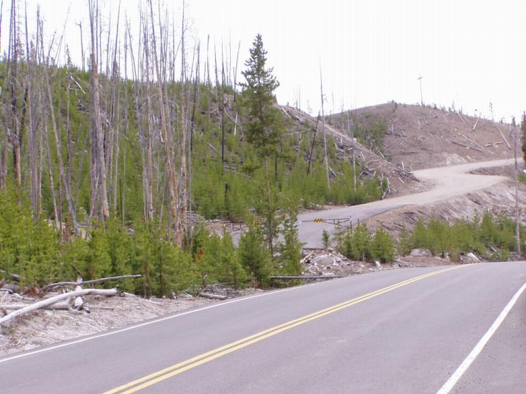
And then around a curve heartbreak hit us: FIRE! Back in 1988, Yellowstone burned - and it still hasn't recovered. The entire park with little exception was devastated. That's the word we kept coming back to: devastated. I don't know if it'll ever rebound.
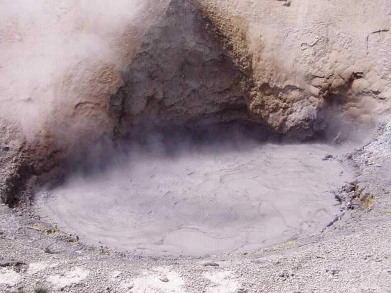
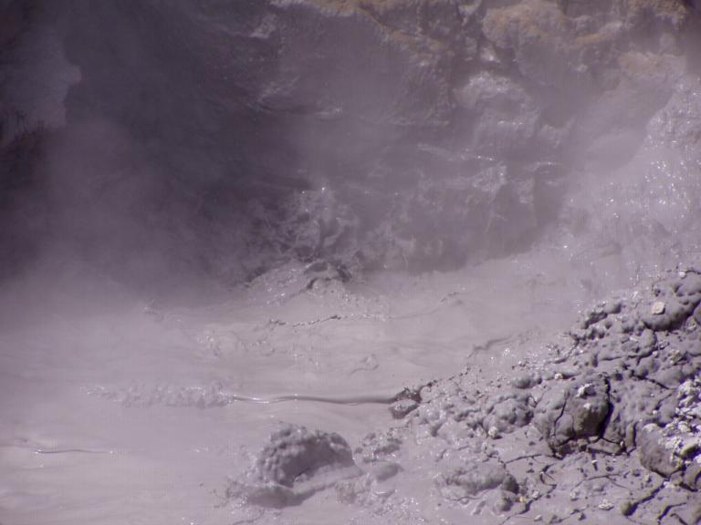
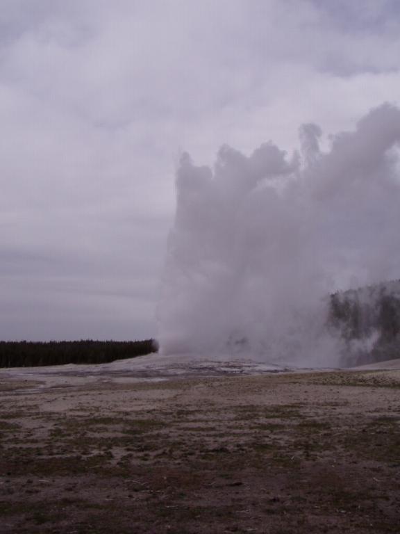
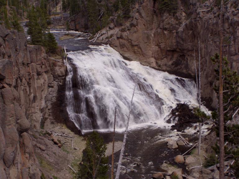
Oh yeah, the mud volcanoes and geysers were still there. It did seem though that many more were dormant this visit than on our last.
So sad were we that we decided we couldn't bear to stay in the park. So, we cut our stay short, drove the loops and left feeling down hearted. We had so looked forward to just enjoying the park; but when we got here, its basically dead. Devastated was the word to which we kept coming back.
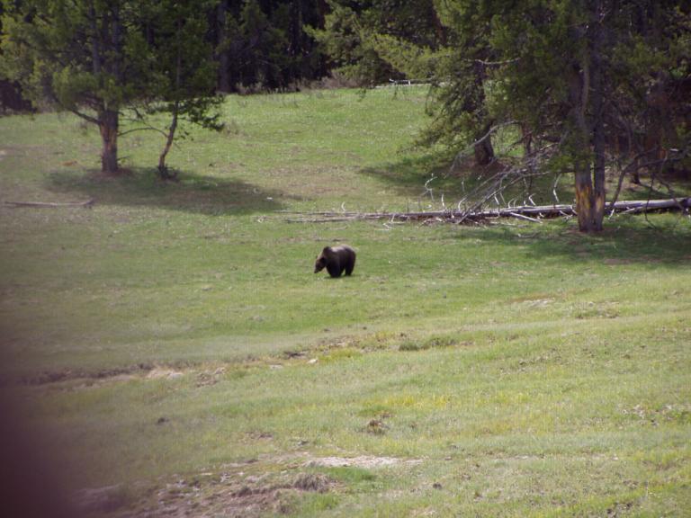
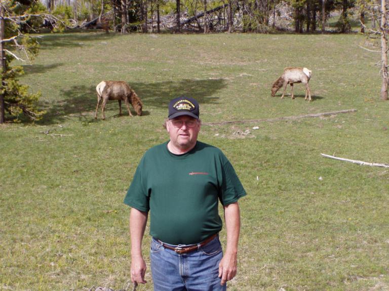
I suppose if there's anything good to come from the fire, its that we saw lots of animals, buffalo, elk, moose, and bear. Yep! Bear. One was a bit off the side of the road foraging in a grassy valley; the other was a a kid playing in the road.
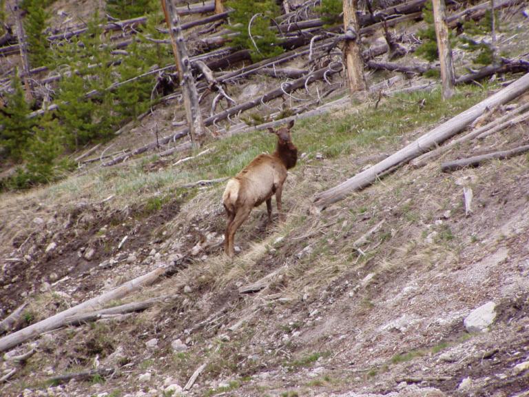
We saw large herds of buffalo, elk and moose. And everywhere the herds grazed, the bark from the young pine trees had been scraped away as the animals struggle to live in the park after most of their food was destroyed. I don't know if the park will live; the animals are eating the little trees, there are signs of erosion. This great gift is, I'm afraid, gone forever. When will we see it in its glory again? Well, it takes 100 years for the trees to reach maturity. So, around 2088 would be a good time to visit! And a few of us for good measure:
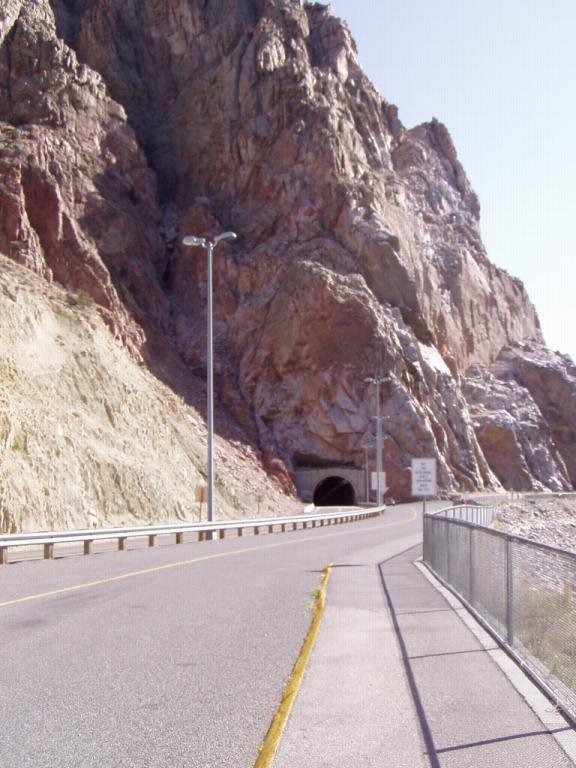
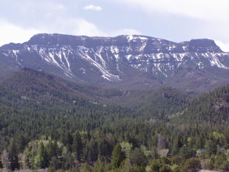
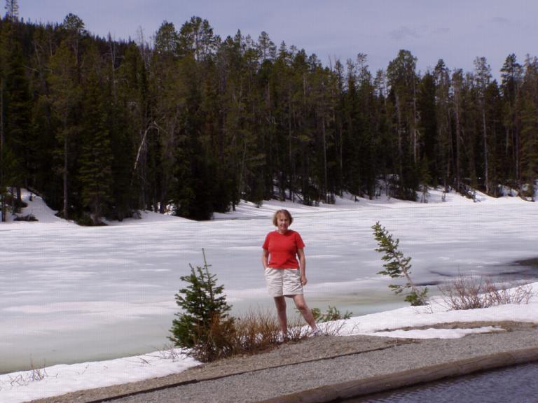
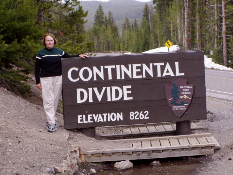
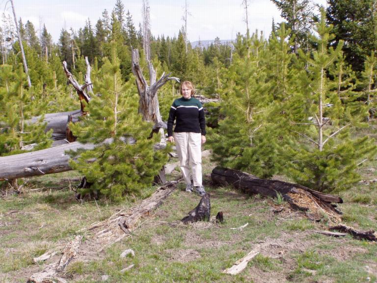
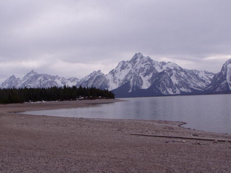
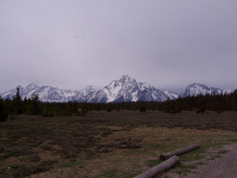
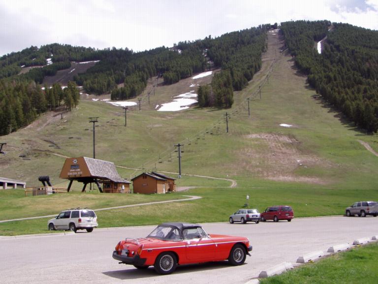
So, we left Yellowstone in silence and sadness and drove to Grand Teton National Park. At least mountains don't burn! Here's a photo right outside where we parked our RV for the night. Day 22 (Sunday, 9 May): 60's, Sunny.
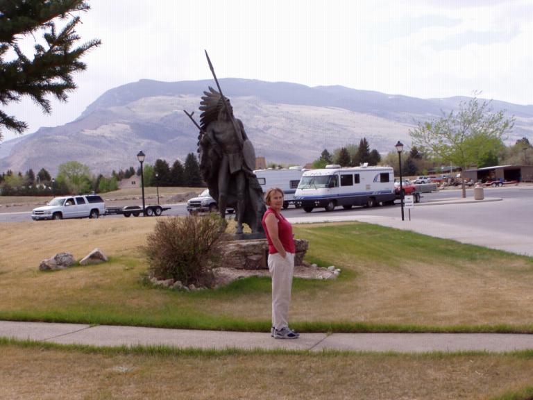
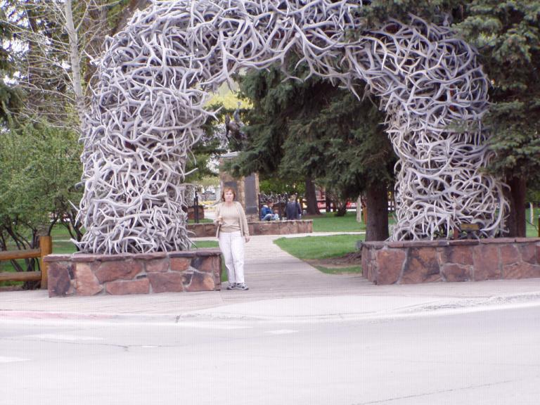
Then it was on to Jackson, Wyoming. Now, some of us call it Jackson Hole, Wyoming. Well, the town itself is Jackson and its located in Jackson's Hole See, the mountain men of old had a habit of calling a high mountain valley that was completely surrounded by mountains a "hole". This particular 'hole' was discovered by Davey Jackson, a beaver trapper in the early 1800's. Jackson Hole didn't see anybody except Indians and mountain men until 1883 when the first settlers came to the region. Today, right outside Jackson is the 25,000 acre National Elk refuge to provide a home for the large elk population and to limit where people can build. Right now, Jackson is building on the sides of mountains surrounding it. But, today was just a relax day, seeing the old town, eating a banana split made with homemade ice cream in the oldest soda fountain in town - one of the original pieces brought with the early settlers. Actually, except for Cody, Jackson is second best place we've visited. Some photos:
|