Day 38 (Tuesday, 25 May):
50's, Rain.
|

|
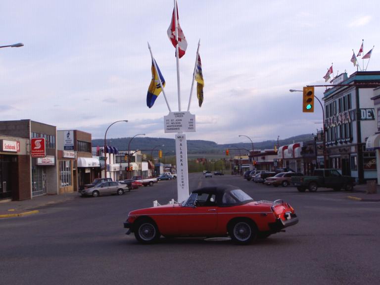
As the RV would've
blocked the entire 'Mile 0" marker, I just parked the MG in
the middle of the street, dashed out and took a photo. I
don't think I was the first to do so as all the locals stopped
in all four directions until I took my photo and got back in the
car. Jerri said they were smiling and waving. Even
the Royal Canadian Mounted Policeman who was sitting in his
cruiser to the left of my patiently waited. |
And we are now officially on the way to Alaska! We're on the Alaska
Highway! I know, I know. We've been on the way to Alaska
since April 18th. But, not really. We've been dinging around
in the US and Canada seeing things of interest. They were only
'time fillers' until the pull of Alaska got real strong. Its so
strong now that we can hardly wait until we see the border!
Dawson
Creek, BC - Fort Nelson, BC (280 miles)
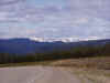
Climb, climb, climb. Boring, boring, boring. Sure, we saw a
black bear and a moose but this stretch of the Alaska Highway is nothing
to write home about. Oops, I just did!
In 1985, Jerri, Shannon and I first drove north on the Alaska
Highway. In 1986, I made a round trip from Fairbanks to Ft. Lewis,
WA on the Alaska and Cassiers Highways; in 1987 I made another round
trip using just the Alaska Highway. Then, in 1988, Jerri, Shannon
and I made a trip south on the Alaska Highway, Shannon - at 16 - driving
her Karmann Ghia all by herself. Since then, the Canadian
government has worked at straightening the curves and flattening the
hills. They've done a good job with straightening the curves, so
good a job that one is rarely on the old highway we used back
then. In one 41 mile stretch near the Prophet River, they
eliminated 132 curves, and in another they rerouted the highway around
Trutch Mountain eliminating some great views of the northern
Rockies! And at another, the Provincial Park that was right on the
highway is not 7 miles off it on an access road.
They've done a passable job of flattening the highway in the section we
traveled today though there's still a 10% grade going down to the Peace
River and several 6- and 7% grades at other places. Plus, Suicide
Hill is still there with its ominous greeting: "Prepare to meet
thy maker". Not far after the hill, we saw a car that had
just flipped off the road. At the campground tonight, I spoke with
a guy who'd come along right after it had happened, apparently the
driver had lost control going down a steep grade. Luckily, there
was a Greyhound bus there to lend assistance.
But, with all the straightening and flattening, they did little or
nothing to make the highway any smoother. Its still like riding a
buckboard wagon on a washboard! I just found the smoothest part of
the highway and rode there. Sometimes I was in my lane, sometimes
I straddled the center of the road, sometimes I was mostly in the
opposite lane. But, that's okay since there's relatively no
traffic and in most places you can see a long way up the road.
With the cruise control set on 55 mph, life's good!
Day 39 (Wednesday,
26 May):
50's, Partly Cloudy.
Fort Nelson, BC
- Muncho Lake, BC (148 miles)
|
|
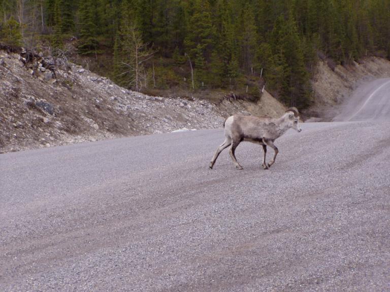
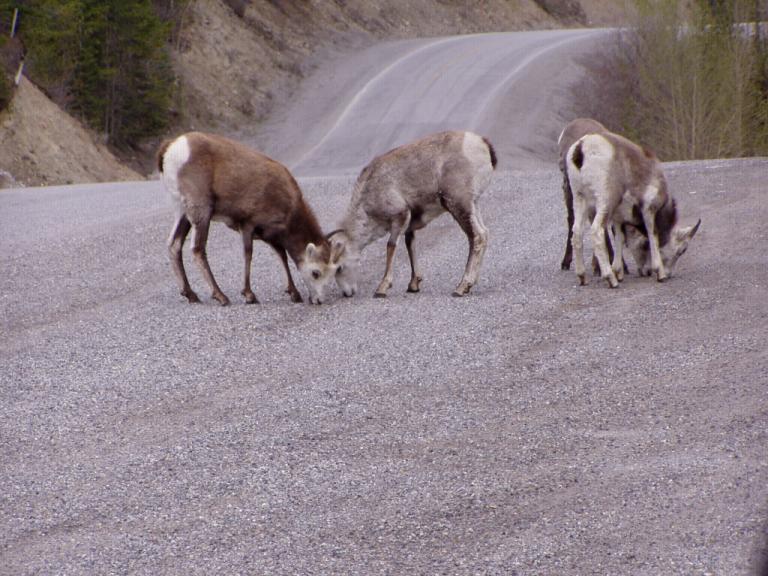
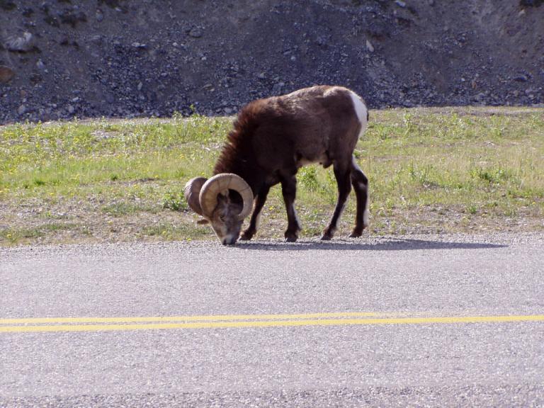
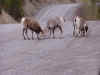
Buffalo, caribou,
moose, deer, stone sheep, bighorn sheep, beaver, badger,
horses, there were lots of wildlife out on this section of
the highway. And if yesterday was a drive along any
Alabama 2-lane state highway, today was definitely the Alaska
Highway. Twisty, curvy, angle banked in places, narrow with no
shoulder, few pull-outs, no safety rails, rough as a cob (err, well, you get the
idea.), gravel sections, and lots of patched asphalt; most of the time we couldn't use the cruise control,
and the ice heaves in the asphalt are becoming obvious.
There are lots
of 6-, 10-. and 12% grades, both up and down.
At least
Steamboat Mountain has been straightened; the 12% grades are still
there but they're straight, and the mountain isn't all the curves we
remembered. Jerri recognized Steamboat Lodge perched on
the edge of its cliff so we stopped for coffee. After our
break, we passed survey crews laying out the route of a highway
or survey stakes marking each curve that would be straightened,
and we occasionally passed sections of the road where fill had
been left over the winter to settle.
|
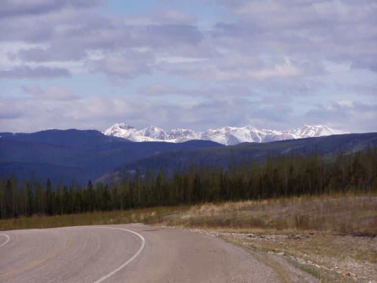
Soon we were crossing through the Northern Rockies. We climbed
until the snow in the distance was oon even with us on either side of
the highway, the leaves on the trees became ever smaller until they were
only buds, and the temperature dropped from the 50's to the 40's.
At the highest point on the highway, Summit Pass (EL 4,250 feet), the
temperature was so cold that Summit Lake was still frozen.
|
|
|
|
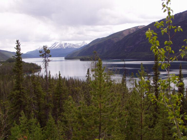
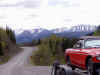
Northern
Rockies from the east. |
Northern
Rockies from the West. |
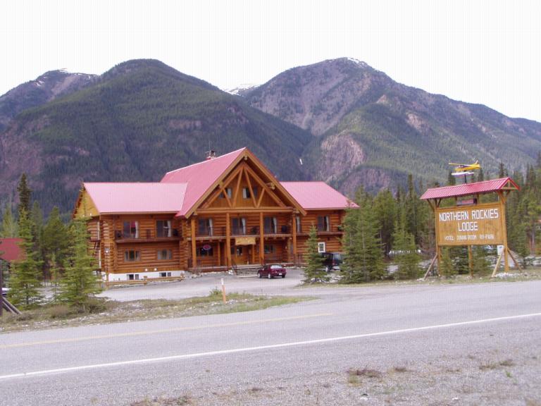
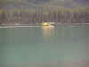
Along the way, we stopped at Toad River Lodge to look at their hat
collection. I gave them one of my "theAutoist"
caps and they gave me a card signifying that it was hat number
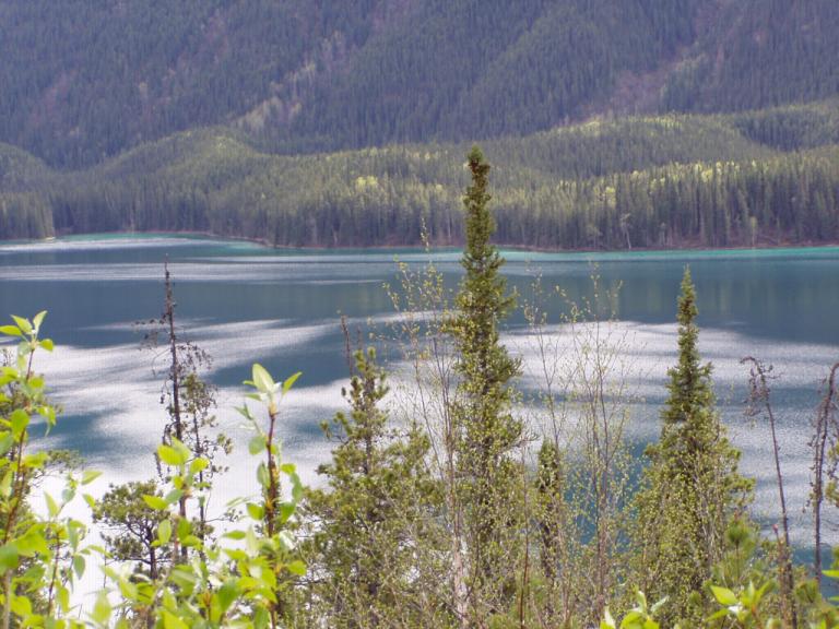
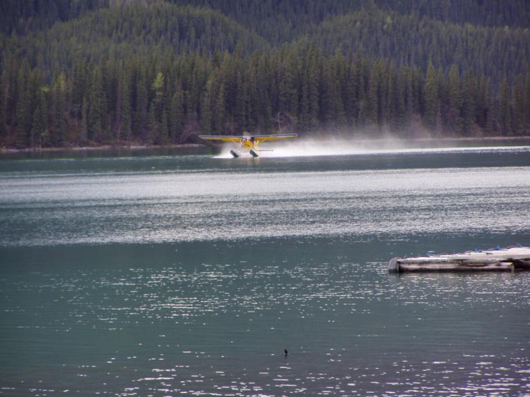
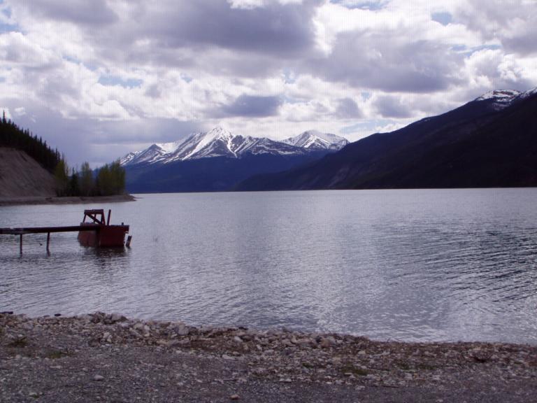
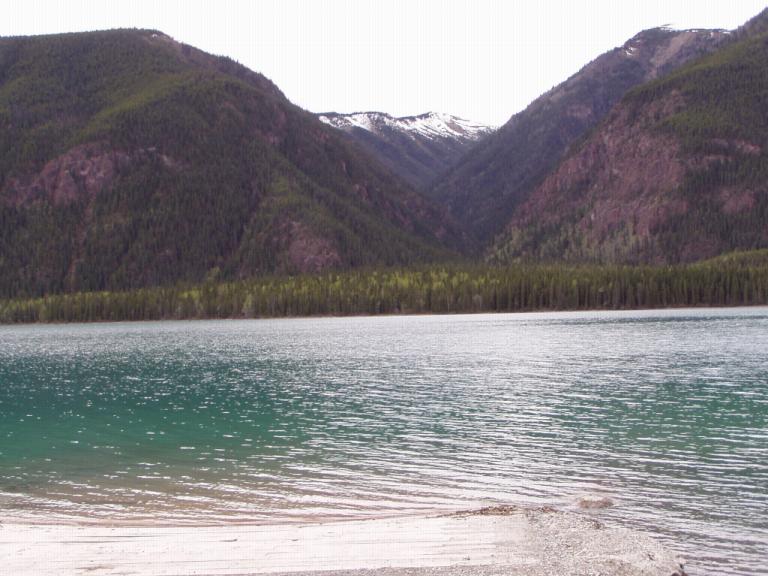
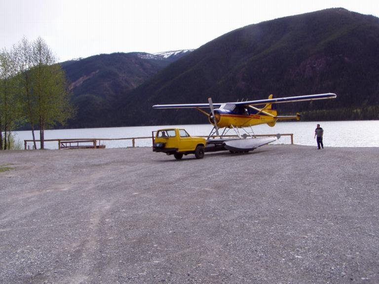
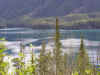
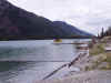
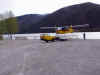
6,423! And then, before we knew it, we were at Muncho Lake, my
favorite place on the highway. Some photos:
|

|
|

|
|
|
|
|
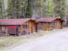
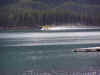
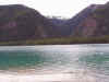
The
"new" lodge. |
In 1985, we
stayed in the little cabin on the right. |
The lake from
the north end. |
The water IS
jade green. |
|
|
|
|
|
|
|
|
|
|
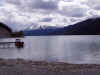
The view from
the door of our RV. |
|
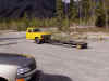
|
The 'gizmo'
they use to get the floatplanes out of the lake |
Here tis!
I just thought it was neat! |
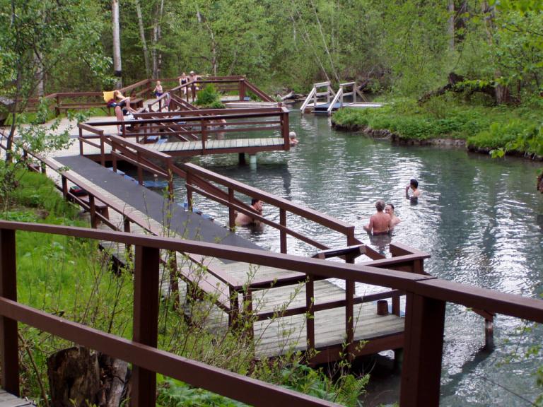
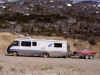
After getting the RV set up, we took the MG off its trailer and drove
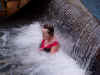
the 40 miles to Liard Hot Springs to work out all the highway
kinks. The springs are a series of natural pools where the water
ranges from 108° to 126°. To get to the springs, you walk about
a half mile over a boardwalk that crosses a wetland that supports
orchids and other tropical plants, in Canada!. Ah, what
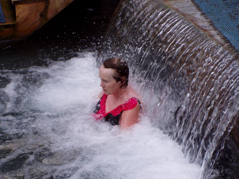
relief! Photos:
|

|
|
|
This pool was
so hot it turned
us bright red! |
Ms Jerri
getting a hot massage
underneath a 100° waterfall. |
After soaking for a couple of hours, it was back to the lodge for one of
their scrumptious German meals: wiener schnitzel with pan fried potatoes
and red cabbage, good German wine and, afterwards, a banana split!
Now I understand Jack London's love for the north land; the pull of
Alaska on us is evermore strong. We can hardly wait to cross into
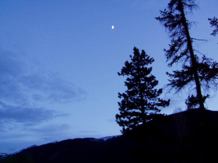
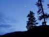
it. Oh, at 10:30 pm, here's a photo of the western sky. No
flash needed and right after watching that weird Tom Cruise movie, Vanilla
Sky, on DVD. A half moon is there but the sky still has an
azure blue glow from the sun that's barely over the horizon, and you can
still see for miles! What an ending to a great day!
Day
40 (Thursday, 27 May): High 40's, Partly Cloudy.
Muncho Lake, BC
- Johnson's Crossing, Yukon (326 miles)
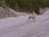
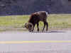
Wilderness, wilderness, wilderness! Horses, lots of buffalo (Jerri
likes the newborn with their "little brown humps and flat calf
faces"), deer, and black and brown bear. About half the day
was spent at 55 mph in cruise, and about half (the afternoon in the Yukon)
was spent on gravel at 20 - 40 mph, sometimes with pilot vehicles leading
us. The RV and MG look tan they're so dirty. I'll wash them
tomorrow in Skagway.
Yep, this is the Alaska Highway I remember, though we've not yet been
given directions like we were back in '85 by a highway construction
worker: "Sir, turn right and follow the tracks until you
come to a big boulder. Turn left by it and go about 2 miles until
you come to a dead tree with a big forked branch. Turn left there
and you'll end up back on the highway." I think Shannon
asked me at every boulder or tree if we were going in the right direction
or if we were lost in the wilderness.
"Keep going," was Jerri's comment throughout the day. "Let's
get to Alaska! We can drive another hour." And that
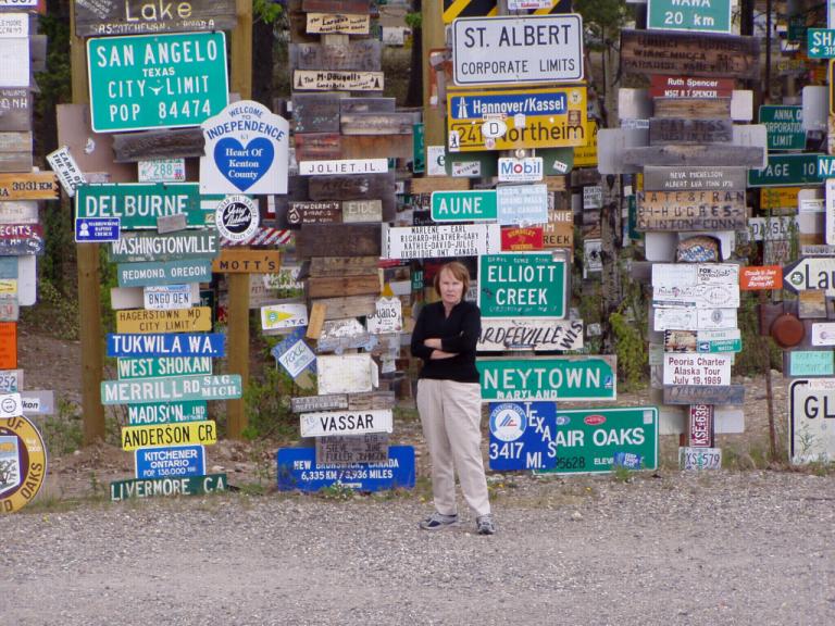
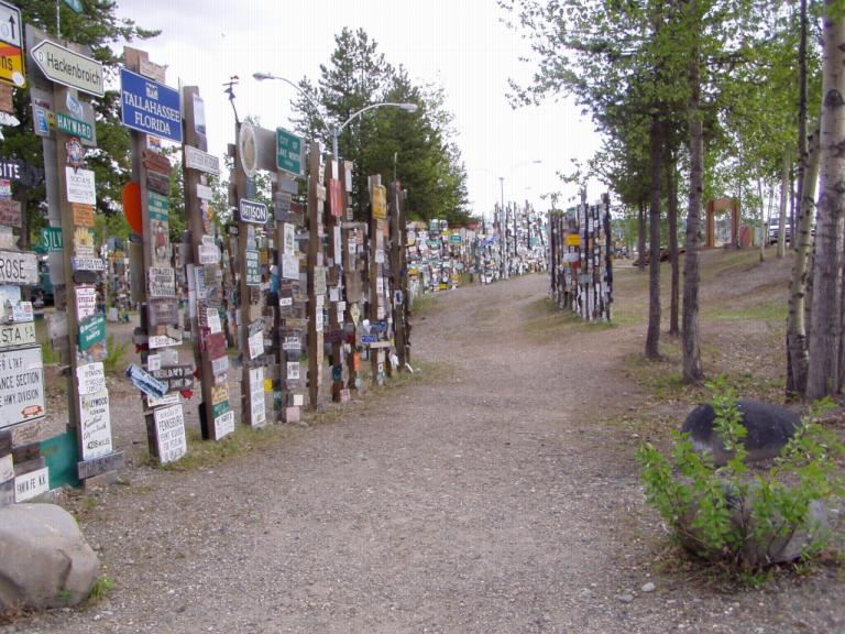
was before we even got to the Yukon! We stopped for lunch in Watson
Lake and visited the 'signpost forest.' Its grown tremendously since
our last visit, so much that they've added a nice visitor's center with
free coffee and an interesting exhibit about building the highway through
Watson Lake. No signs there from Gurley though.
Then,
it was onward towards Skagway. As we came into the little Tlingket
Indian village of Teslin, I suggested we stop at the same place where we'd
spent the night back in 1985 as they've now added a nice RV park on the
lake.
"We could drive a bit longer if you'd like." was Jerri's
suggestion.
A bit down the highway, I stopped at Mukluk Annie's, a real tourist spot
on the highway. Neither of us liked it so Jerri volunteered to look
in the 'Milepost' to see what was down the road "a bit closer to
Alaska." So, here we are, 128 miles from Skagway,
tomorrow's destination - and the place where we WILL stop
for a few days!
|
Links
to the main portions of the journey so far: |
|