|
The
Heart of Alaska |
|
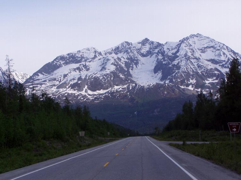
Fairbanks - Valdez, AK (Richardson Highway - 363 miles) Even in the rain, Jerri and I both concluded this is the prettiest scenery we've seen in Alaska. Especially from Glenallen to Valdez. We spent the morning, actually the entire day, following From driving level with the rivers, we soon climbed above the tree line and into the snow, and then down to the rivers again. It was like that all day. Above the tree line is always an interesting place. You never know what type growth, if any, you'll find. One time there's only rocks, another moss and lichens, and still another there's scrubby little bushes that if given a chance at lower altitudes could become trees. And what trees we came upon near the edge of that barren world were skinny, short, and twisted as though they were trying their best to maintain a hold on the earth below them. Throughout it all, the pipe line was ever present on one side of the road or the other until it dipped into the ground to appear again in a few miles. Around mid-afternoon, when we came to Summit Lake (EL: 3,210 ft) up above the tree line and it was still partially frozen even though the weather back in Fairbanks was in the 80's!
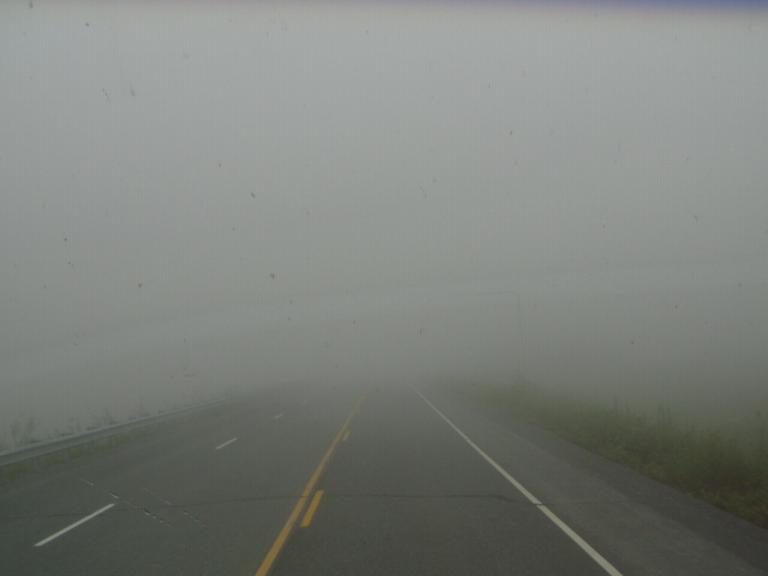
Then, we began our final 7-1/2 mile descent through the mountains from Thompson Pass (EL: 2,678 ft) where we went into the clouds until we dropped down into the cliff cuts on either side of the road along the Lowe River trench. From that point to Valdez, we were under a heavy shroud of clouds.
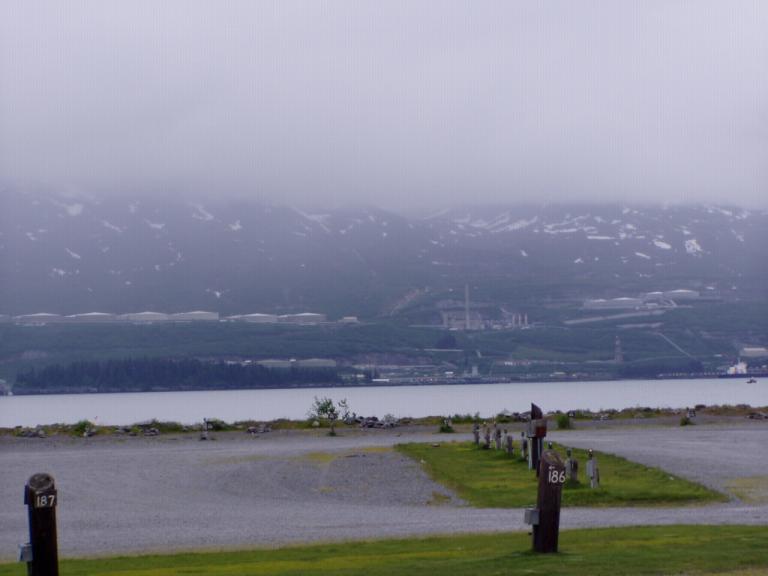
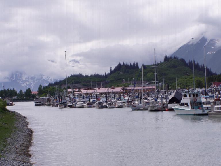
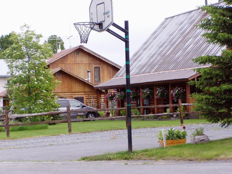
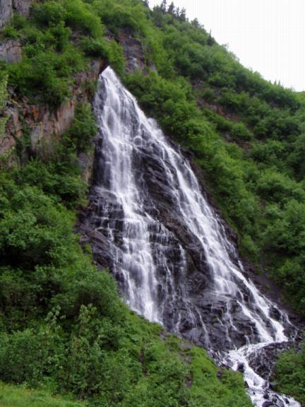
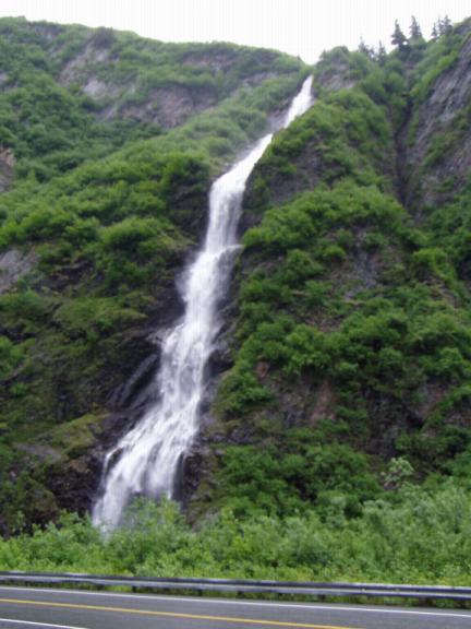
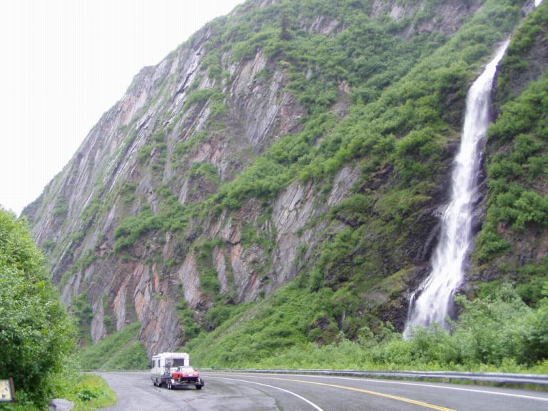
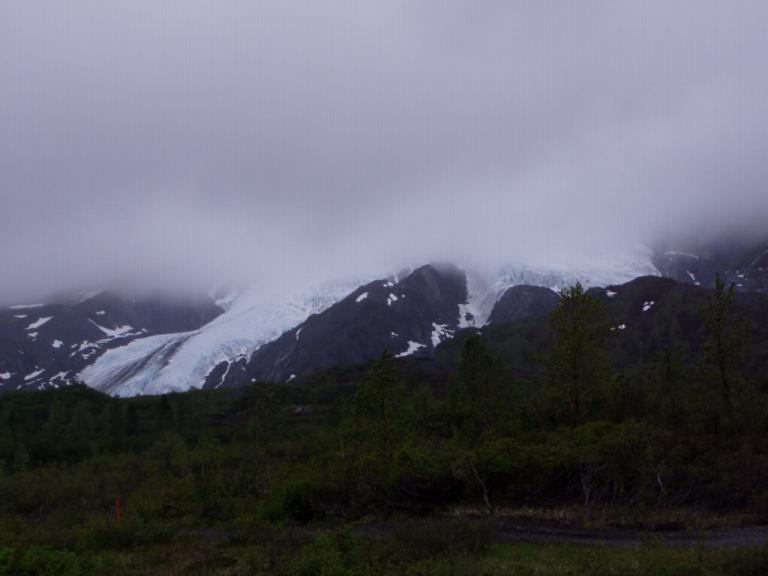
When we leave Valdez, I'll try to get some photos of the glacier, the numerous beautiful waterfalls, and the gorgeously green countryside on either side of the road, if the sky cooperates. If you only get to drive one highway in Alaska, make it the Richardson. Oh, from a constant 24-hour daylight in Fairbanks, we're under the clouds enshrouding Valdez; and, at 11 pm, its dark for the first time in weeks! There are 19-1/2 hours of daylight right now so there's daylight above the clouds somewhere, it just can't permeate them. They hang around the mountain outside our dining window like a scarf around a woman's neck. How unusual it seems. Day 52 (Tuesday, 8 June): 50's & Overcast. Valdez, born from the gold rush days of 1897-98, has had its share of bad luck. From the March 27, 1964 Good Friday earthquake which destroyed the town to the March 24, 1989 (another Good Friday) grounding of the oil tanker Exxon Valdez, it has twice risen from disaster to become a fishing and tourist destination. Actually, while we're visiting, the Valdez Fishing derby is underway with a $15,000 first prize for the fisherman who lands the largest halibut. Halibut. We thought we'd found the best tasting halibut back in Skagway, but the halibut we had for lunch today makes that taste like frozen cod! We're talking fresh off the ship. And, if you don't want to go to a restaurant, its also available by the pound right on the dock - for only $7.95 per pound!
Something else I learned from talking with locals: there's only about 26 days of sun annually where the temperature rises above 70°! Clouds are commonplace around here, the sun isn't. "We had some nice sunny days around the end of May." our waitress, a local college student home for the summer, told us. "And in July it'll get sunny again; and real hot, around 80." So much for waiting the cloud cover out for better photo opportunities! Actually, because of that cloud cover and the mountains that completely surround the town, Valdez gets more snow than rain, 325 inches a year on the average. That's 27 feet of snow a year! I remember when I visited Valdez back in the 80's, the snow was higher than the houses and there was this one guy shoveling snow off his roof - and he was tossing it up onto the pile because the snow around his house was higher than his roof!
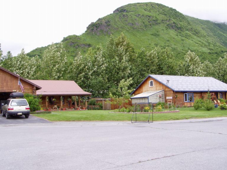
Because of the 1964 earthquake, Valdez has been completely rebuilt, in a new location. The ground at the old town site was considered too unstable so the entire town was rebuilt on its present location. The museum has a little model (little, heck, it covers an entire warehouse floor!) of the old town down to stacks of lumber and wooden sidewalks. Out at the old town site, there's a National Parks monument and some of the old pier pilings and building foundations are still evident.
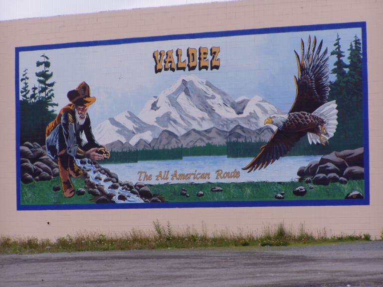
Valdez, like many other northern towns is covered with murals, even some houses have them. Jerri thought this one was especially attractive and describes Valdez's early importance to the gold rush.
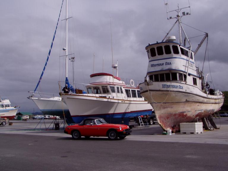
Seems back then some idiot Army lieutenant named William Abercrombie mapped out a trail from Valdez to the Klondike over the Valdez Glacier and through the Copper River basin. Problem was, he never actually traversed it before he named it the "All American Trail" and advertised it as an established route to the Klondike. Well, 4,000 prospectors arrived to find not only no city but also no trail! So, Abercrombie and his men set out to build a trail through Keystone Canyon and over Thompson Pass. Later, the Army established Fort Liscum at Valdez and gave Abercrombie the mission of building a road from Valdez to Eagle up near the Klondike, part of which later became the Richardson Highway that we drove yesterday. After dinner, we went to the weekly Valdez Museum Summer Cultural Crossroads Program. Tonight it was a presentation of traditional Alutiiq Indian dancing. The dancers aged from around 3 to adulthood. To me, their costumes and language were almost hinted of Samoan or Hawaiian descent. But, it was a great hour and a half free program, and it was neat to watch the little kids discovering their culture. On the way to the program, we were driving down the street when we passed a green '79 MGB with chromed wire wheels coming from the opposite direction! We both turned around in the road and had a neat conversation. We're getting together tomorrow as he needs a new top and I priced him one for less than Moss or the Octagon, his usual parts suppliers. Its the first MG we've seen in Alaska (though we did see a TR-6 in Fairbanks). And while we were at the Alaska Ferry terminal, we met a guy who has 2 MGA's over in Cordova. Business again! Day 53 (Wednesday, 9 June): 50's, Overcast, w/am drizzles. Valdez - Wasilla, AK (Richardson, Glenn & Parks Highways - 268 miles) Well, after breakfast, we decided to pull up stakes and head west. The clouds were still there and the sky hinted of rain, but we headed out over Thompson Pass and, yep, once again ran into clouds up there. It was almost Brigadoon-esque. What's on the other side of the clouds? Did Valdez go to sleep for 100 years when we left? Oh well, we got some decent photos before the rain came down.
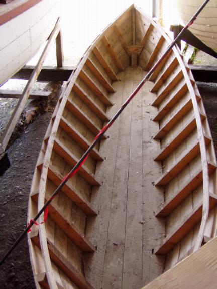
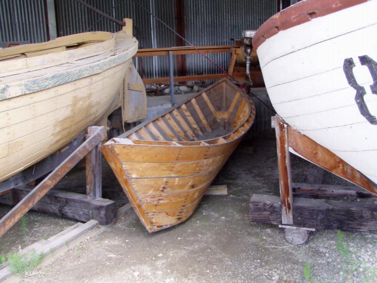
And it didn't get in this condition overnight. Or, over a winter. Or two winters. To get in this condition took a long time. I can only repeat: the governor and people of Alaska should be ashamed of themselves. And they should fire the guy who's responsible for the upkeep of the Glenn. It is absolutely the worst image that can be attributed to the state: the highway into its largest city - the busiest highway in the state - is falling apart. Crumbling edges, no shoulders, dips, sink holes, cracks, broken pavement, gravel, this highway is the worst of the worst. Nowhere from Glenallen until Sutton can you get up to cruise control speed. The only way to correct its problems is to tear the roadbed apart and start all over again, something they're doing in several places (along with the half hour waits for a pilot vehicle to lead us through the one-lane construction sites)! Band aids won't work anymore, there's already been too many of them. A driver can't enjoy the scenery because if he takes his eyes off the road, his vehicle might be completely in the air over one of the many bumps or off a cliff around one of the many curves. Jerri told me we passed the Tazlina and Matanuska Glaciers (and told me they were absolutely beautiful) but I never saw them I was so engrossed with the lousy road conditions. And I've got to drive back up it again in a few weeks! And if you think the worst is over when you reach Eureka Pass (EL 3,322 ft) you're badly mistaken. The road gets worse the farther west you go, the hills get harder to pull, and the down grades get steeper. All with no shoulders and no guard rails. This road sucks! If I didn't have bad shocks and brakes when I got on it, I'll bet I do now! When I get to Anchorage to have the RV serviced, I'm gonna check them both. We passed a couple of Spitfires and Midgets in the backyard of a house on the eastern outskirts of Palmer (even here I can still spot them!). I also met a young fellow who's grandfather (probably my age) has a '75 B, and the obnoxious owner of an RV park in Palmer where we inquired about vacancies told me he has a '78 B. When I told him mine was a '79, he chuckled and said out loud to his wife (also obnoxious), "These tourists all bring new cars into the state." My answer? "Well, if you'd like, I'll go home and return with my '53 MG!" No retort from him. After we checked into an RV park in Wasilla, and when Jerri and I had left the office to hook up our rig, we looked at one another and said that the owner reminded us of my late Uncle Orland and, surprisingly, his wife reminded both of us of my Aunt Burnice, Uncle Orland's widow. It was as if they've both been regenerated into a new life up here. Weird! Day 54 (Thursday, 10 June): 60's, Sunny. Wasilla, just 44 miles from Anchorage, is a bustling bedroom community of that city. There's more traffic here than we've seen in weeks (well, at least since the Seattle area). And we've run into the cruise ship tours again. Plus, Walmart, Fred Myers, and all the big boxes are here. However, Wasilla's museum is pretty neat. You go down a set of stairs designed to make you think you're entering an underground gold mine to a series of displays about the early years of the town. Out back of the museum, they've moved and grouped several of the original buildings where they can be viewed. There's the original one-room school, an old sauna, and several log cabins and barns. Just outside of town is the Alaska Transportation and Industry Museum which houses everything from old snow mobiles to jet airplanes. There are old road building equipment, fire trucks, early Army trucks, tractors; heck, there's anything that had to do with transportation in the state during its formative years. There are old helicopters, airplanes, and the first hang glider to be used off the top of Mount McKinley (Denali). There are old wooden fishing boats, tugboats, and an early Alaska yacht. And sandwiched in between a couple of double ended wooden fishing boats, I found one of the Klondike boats that were crudely made to transport prospectors upriver from the coast to the gold fields.
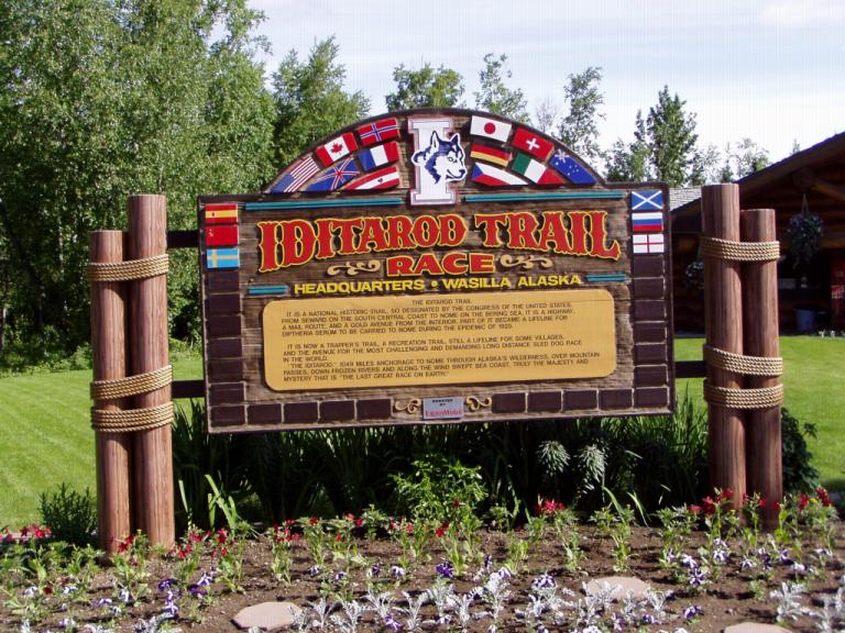
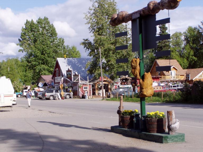
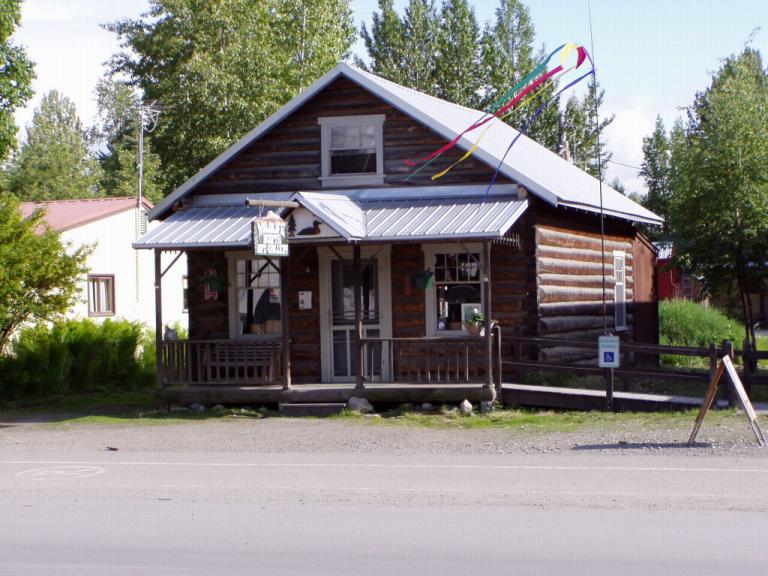
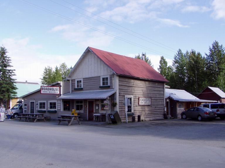
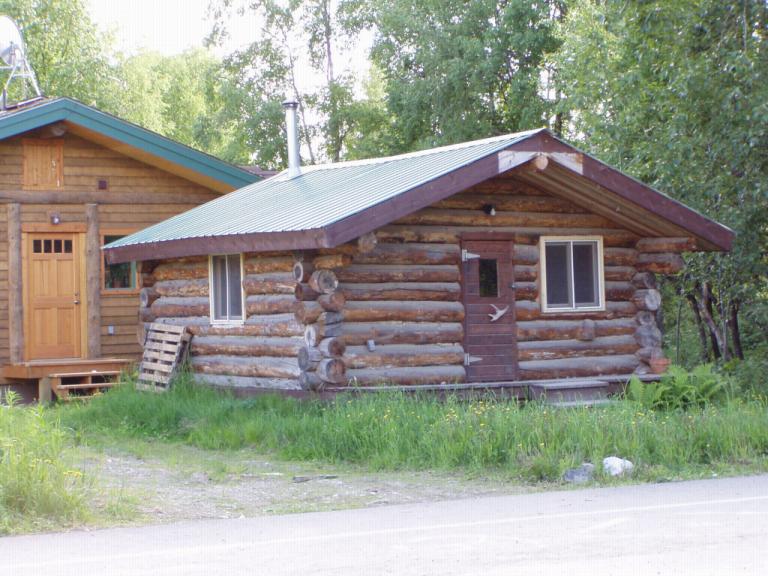
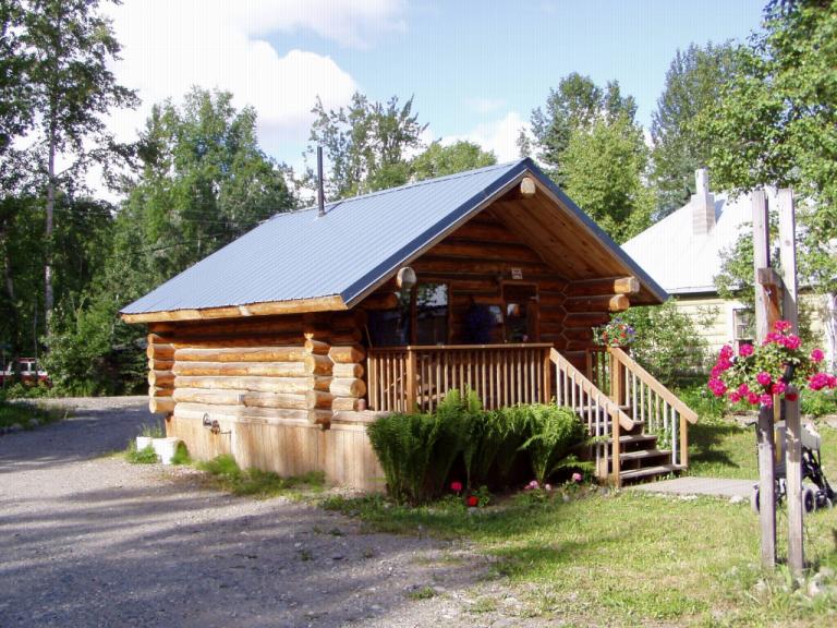
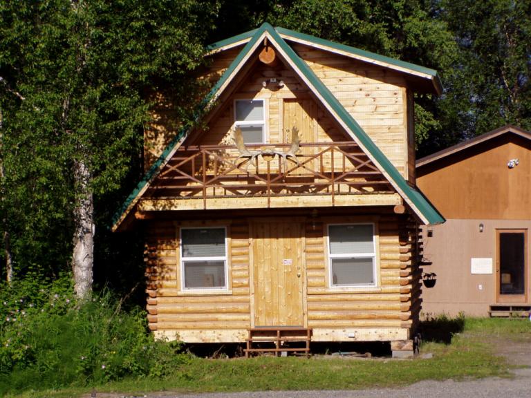
But, they continued to bug him or cut in line for a ride, regardless of how many people were waiting behind them. They've become the "ugly" tourists and have taken over where the "ugly American" quit. (When I got up to leave the movie about 5 minutes before it was over, one of the Japanese men started yelling, "Not finished! Not finished!") So, we left the Iditarod site without even spending time in the gift shop! Oh, on our way to a Pizza Hut (first pizza we've had since we began the trip!), we passed a TR-6 at an intersection. He was turning right and I was going straight so we both honked and waved. Near the Pizza Hut is a lake with a beach and ringed off swimming area. Though the temperature is only in the high-60's, the place was full of sunbathers and kids swimming. I suppose when summer's as short as it is here, you take what time you can get. Day 55 (Friday, 11 June): 60's, Sunny. Wasilla - Talkeetna, AK (Parks Highway - 70 miles) After driving 14-1/2 miles down Talkeetna Spur Road - the model, by the way, that Alaska should use for rebuilding the Glenn Highway - off the Parks Highway, we arrived in the quaint village of Talkeetna. But, back to that spur road to Talkeetna: ultra smooth, wide shoulders with a bicycle path along the entire route; by far the best road we've driven in Alaska or Canada! Talkeetna has a three-block historic district where the town's original saloon and roadhouse are still in operation. Its home to artists and craftsmen, bush pilots and river guides (3 rivers converge in the woods). In early summer, mountain climbers from all over the world come to Talkeetna to challenge Denali (Mount McKinley), the highest mountain in North America. Main street is the only paved road in town (and it dead ends at the Susitna River!). The town is full of log cabins and clapboard houses, both old and new construction. Seems fiddlehead ferns are the big thing around here and there's even a farm dedicated to them. The Alaska Railroad runs right along the spur road with a station in town where you can jump on for a ride into the wilderness or to Fairbanks or Anchorage. And its the only whistle stop railroad line left in the country. From Talkeetna, you can ride about 55 miles into the wilderness getting on or off anywhere you like. Just tell the conductor you want to get off and he'll stop the train. If you want to get on anywhere along the route, just wave a white flag to get the engineer's attention. He'll whistle to let you know that he sees you and then stop to pick you up. The conductor charges you based on how far you'll be going and on whether or not he thinks you have excessive baggage (anything over 100 or so pounds).
We've also learned there are a few differences in RV-ing up here and back home. Up here, you stop for a day or so and then move on. Back home, you set up for a long weekend or maybe a week or longer. So, up here you rarely unfurl your awning, our large propane barbeque grill is too cumbersome, and you rarely hook up to sewer systems, relying instead on dump stations to empty your tanks every few days. Here, everybody uses small propane grilles about 12"x18", though we've not yet bought one, and we've learned we can live 4 or 5 days before we have to dump our tanks. As we were relaxing after dinner with the RV door open but screen door closed, Jerri looked up and there was a guy standing there. "G-day. May I inquire about your MG?" He was from Australia and is spending a few weeks in Alaska. He had seen a Midget on the road earlier in the day and was wondering if there was an MG 'confab' going on. We had a long conversation as he's into historic racing with an MG-TF, an Austin Healy 3000, and a Porsche 911. He left with my card and a promise to visit my web site when he got back to Oz. Day 56 (Saturday, 12 June): 60's, Sunny in morning, Rainy afternoon. Talkeetna, AK - Denali National Park, AK (Parks Highway - 153 miles)
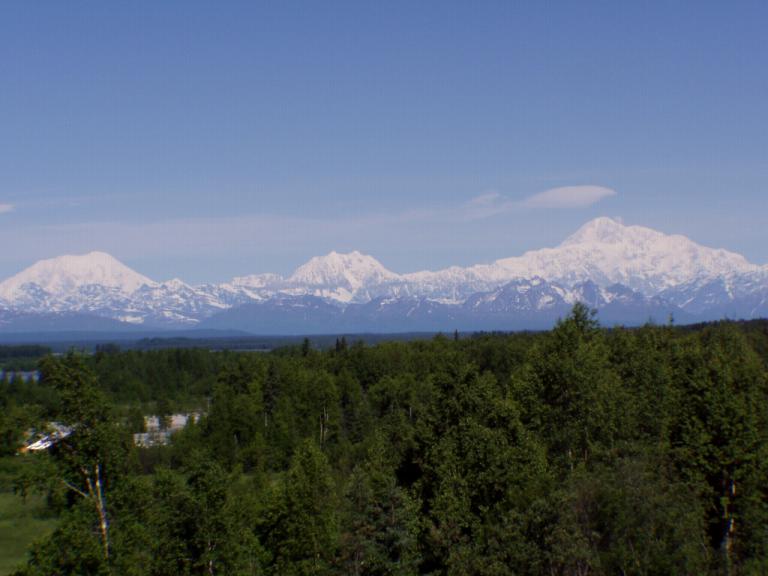
Yesterday at lunch we spoke with a couple who were just returning from Denali National Park. They had been there for a week and never got to see the mountain because of clouds. Actually, since the mountain is only visible 25 - 30% of the time because of cloud coverage, we decided that if the sky was clear we needed to head to the mountain. When we woke this morning, there wasn't a cloud in the sky. Just outside Talkeetna at the first Denali viewpoint, the mountain was out in all its glory. So, we headed north. At every viewpoint, we saw it from a different vantage point, always clear and fabulous. Then, the closer we got to the national park, the farther we got from the mountain and the more overcast the day became. When we finally arrived at the park entrance, it was a gray, overcast, drizzly day. And we had driven so far north that the mountain wasn't even visible. I'd forgotten that the mountain is so far away when you're at the park entrance. There's a reason all the climbers start from Talkeetna, its closer to the mountain by air than from the park headquarters itself. You don't really need to drive all the way up to the park if you want to just view the mountain. Just stop at all the Denali view points along the Parks Highway (there are a dozen) when you're driving up. The mountain really isn't even visible from the park headquarters, you have to take one of their buses some 10 miles into the park before you can see it. The best vantage points are only about 40 or 50 miles north of Talkeetna. And things have really changed around the park entrance since we were last here. Now, they call this section of the Parks Highway "Glitter Gulch", and there's good reason. On the west side of the highway, all you see are hotels, lodges and cabins owned by the various cruise ship lines with their huge restaurant/gift shop/lounges and acres of parking for their tour buses. On the east side of the highway there's nothing but gift shops, restaurants, RV parks, filling stations, all designed to take the tourist dollar anyway they can. There's even a Subway fast food restaurant and a Harley Davidson apparel shop! Here's an example of blatant price gouging: right outside Talkeetna on the Parks Highway at the Tesora station, gas is $2.095 a gallon. A hundred miles away at the Tesora station in "Glitter Gulch" the same gas is $2.439 a gallon, and you have to pay before you can pump! Heck, in Talkeetna the RV park was only $22 but here its $30 and the park's not nearly so nice. Rip off! Everything's a tourist rip off! And they've got you captive as you've no place to go for 125 miles either way! The entire area outside the park itself is a tourist trap that you can easily skip. And we left such a neat spot in Talkeetna to drive up here, for nothing! Day 57 (Sunday, 13 June): 70's, Sunny. Denali National Park, AK - Palmer, AK (Parks & Glenn Highways - 206 miles) Twas a good thing we drove northward towards the mountain yesterday. Today, the clouds had enfolded Denali in their embrace and she was hidden from sight. However, even without views of the mountain, the drive south on the Parks Highway was beautiful. And unusual. First, we saw a southbound truck pulling a '66 Mustang fastback on a trailer; then, we passed a northbound SUV pulling an old Singer convertible on a trailer; next, we passed an MG-TC heading northward under its on steam, the driver its lone occupant; finally, an old 50's-something blue and grey Rolls Royce Silver Cloud pulled out in front of us heading south, left hand drive with a passenger, they appeared to just be out for a Sunday drive. And when we got to the RV park in Palmer, there was an old 40's 1-ton newly restored Dodge farm truck on a trailer just heading out for Homer. A car day, it was! Oh, we also saw a mother moose and her cub! Huntsville had its Aunt Eunice. Alaska had its Mary Carey. We stopped for lunch at 'Mary's McKinley View Lodge' and Mary's daughter, Jean Richardson, was sitting in a stuffed chair in the gift shop greeting customers and signing her childrens' books, of which she's written several. Her mother homesteaded on that spot before Alaska became a state, fought for completion of the Parks Highway, and is presently the subject of a movie about her life in the Arctic. Ms Richardson appears to be in her 80's and was full of life wanting to know everything about everybody who entered her domain. A little guy and his family from Georgia who we'd met before over in Canada came in as we were leaving. He's 5 and a real talker. He and Ms. Richardson got into a conversation that ended with him heading into the dining room for lunch with one of her autographed books. I suppose every state has its maternal figure. Alaska may be changing but so long as there are a few of the old 'sourdoughs' still around, it'll continue to have its pioneer spirit. A 'sourdough' is a person who has wintered over in Alaska through at least one winter. Hmmm, Jerri says I was a 'sourdough' before I ever spent the first winter night in Alaska! Wonder why? As we were exiting the lodge, a group of young 20-something guys were lounging on a bench by the door. "Tourists," one of them exclaimed a bit too loudly as we walked past in our Alaska tee shirts. "Oops, sorry, sir. I didn't mean anything by that." "Tell me, son," was my uptake. "How long have you lived in Alaska?" "I've been a seasonal worker for the past few years since I got out of the Navy." he answered. "Then you're the cheechako," I answered. "I'm a sourdough! I first got here in '85, before you were born!" His friends guffawed and punched him as he turned crimson red. You see, a 'cheechako' is a person who hasn't wintered over, in other words a 'cheechako' is a tourist! Day 58 (Monday, 14 June): 70's, Sunny. Palmer is Anytown, USA. Small, agricultural, a bedroom community to a larger city, Anchorage. Other than the snow covered mountains surrounding it, you could be anywhere. There's a Taco Bell and a local Mexican restaurant, there's Fred Myers, McDonald's and anything else you want nearby. Ten miles from Wasilla, its larger sister, it provides rural living in an urban setting. Actually established in 1916 as a railroad station, Palmer has evolved to become the commercial center for the Matanuska and Susistna valleys. In 1935, the Federal Emergency Relief Administration, one of the many New Deal agencies created during FDR's first year of office, started the Matanuska Valley Colony to get some farm families struck first by the Dust Bowl and then by the Great Depression off the dole. Social workers picked 203 families from Michigan, Wisconsin and Minnesota to start the colony. Many of their descendants still live in Palmer today; and Palmer still retains its agricultural economy with a growing season of 110 days of long sunshine. Interestingly, the one thing that seems to cost more here than anywhere else is fresh produce! A medium size tomato cost $2.00, and 2 peaches and an apple cost $3.85! Conversely, lunch at the little Mexican restaurant was the same as any restaurant around Huntsville; and my mid-afternoon ice cream cone snack was actually less expensive than one in Huntsville! What about teacher salaries? We talked with a teacher and found that their salaries are on par with those of Alabama teachers. The days of moving to Alaska and doubling your salary are gone; you'll be lucky to maintain your salary level! So, what's different about Palmer and Anytown, USA? The weather. And that's unusual also: Palmer is actually warmer in the winter than many places in the three states from which its original 'pioneers' came. Jerri and I were commenting at lunch that we're glad we aw Alaska back before things completely changed. Sure, it wasn't the same as right after the highway was built or back in the heady days of statehood. But, the Alaska of the 80's is a thing of the past. Unless you stumble into Talkeetna, Homer, Seward or one of the other little villages not yet infected with the big boxes and the cheechako's who follow. Alaska seems more and more to be taking on the appearance of just another Pacific coast state - at least the densely populated areas are! Alaska always had its share of eccentrics. Now they're just 'fruits and nuts' who're escaping California! Tomorrow, we go to Anchorage for a week.
|