|
Dipping into Alaska |
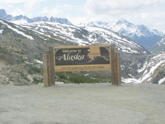
This short section will cover our brief dip into Alaska at Skagway and our adventures there and in Haines before we go back to Canada for our final drive up to the 'body' of Alaska. Day 41 (Friday, 28 May): High 40's, Partly Cloudy. Johnson's Crossing, Yukon - Skagway, Alaska (128 miles) The excitement of finally getting near Alaska captured us both. With great anticipation, we awoke at 7am and, after a breakfast of hot, fresh cinnamon rolls at the roadhouse in Johnson's Crossing, we set out. We could feel it in the air; just a short hop and we would be back in the USA!
We climbed up above the tree line to an elevation of 2,292 feet and then descended a 10- to 12% grade for 12 long miles to sea level. I cranked my trailer brakes up as high as they would go and could still smell my brakes by the time we'd descended into Skagway. And I don't want to go back over the Dawson Range again!
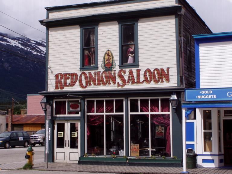
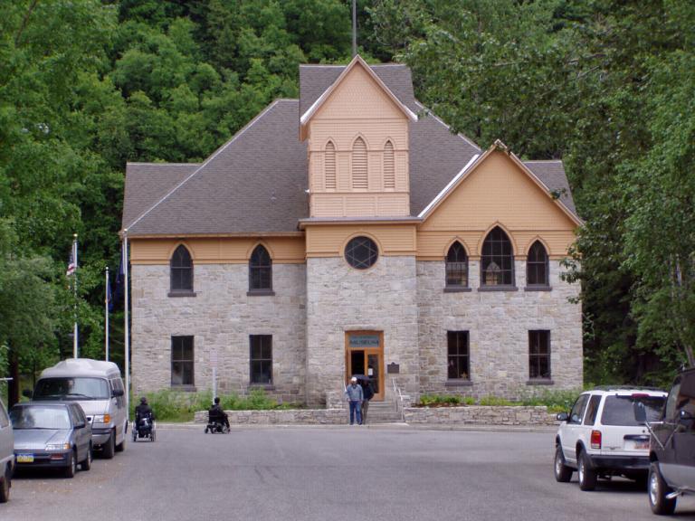
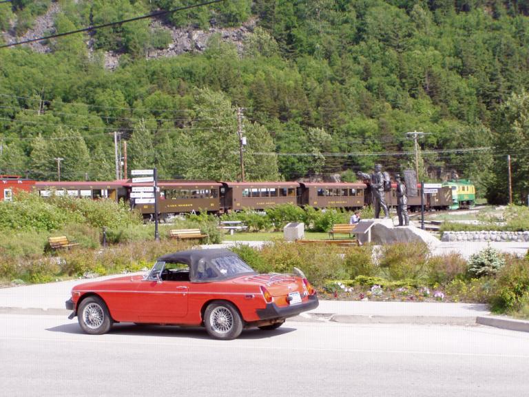
We arrived in Skagway around 9:30 am, got a spot in a great RV park, and made our reservations for the ferry to Haines, AK, Monday evening at 7:15 pm. That 1-hour ferry ride will save us a 9-hour, 2-day, 352 mile drive, part of it back up over the Dawson Range! The total cost of our 2 tickets and the RV and MG's ticket was $181 but it was money well spent! We couldn't drive it that cheaply, even if I wanted to! Then, while Jerri did laundry and got in her daily walk, I spent the afternoon washing the MG, its trailer, and the RV. They're clean again! After dinner (Jeff, FYI: a red leaf lettuce and green onions salad smothered in hot bacon grease with grilled pork chops, and mashed potatoes), we took a walk around downtown Skagway to get our bearings. We stopped by the Red Onion Saloon for an after dinner drink and a breather during our walk. For those not in the know, the Red Onion was established in 1898 as a saloon and the 'fanciest brothel of the Alaska-Yukon gold rush'! Today, the Red Onion is 'the' evening meeting place in Skagway for the locals and, of course, tourists. Isn't it interesting how words get their meaning? The Red Onion had 10 ladies working upstairs in tiny rooms called 'cribs'. Remember back in the '70's when a small apartment was called a 'crib' by some ethnic groups? Just like that same group has no idea of the origin and reason for the sagging pants they sport, I wonder if they know where the word 'crib' got its start? Day 42 (Saturday, 29 May): Low 50's, Partly Cloudy. After breakfast we stopped by the Alaska Marine Highway ticket office to inquire about traveling from Haines, AK to Prince Rupert, BC, Canada instead of driving all the way back home from Alaska. We could do everything we wanted in Alaska and drive to Haines to take the ferry through the inland passage, a 2 day cruise versus 7 or so days driving the Alaska Highway (which we just did!). Think we might just do that. It would be a change, kinda like a mini-cruise. Now, we'll have to chose an 'end date' for our Alaska visit to make the reservations. Then, we went shopping and toured the old downtown section of Skagway, taking in a movie about the city's history at the National Park service Visitor Center. I didn't know that a large portion of Skagway is a national park!
Around noon, we had lunch at the Skagway Fish company down on the pier. Fresh, cold, boiled Alaskan shrimp as an appetizer followed by Alaskan Halibut for the main course. To die for! Then, I sat down on a park bench and spent the afternoon watching an old ice house being moved. The National Park Service owns 16 buildings in Skagway, the ice house is now number 17. It was built in 1903 and is the last remaining building of its type; so, when the owner gave it to the Park Service with the stipulation that it be gone by May 31st, work began. All afternoon the crew was jacking it up, shoring it, and preparing to roll it across the street. When the actual move started, I noticed a couple of park rangers taking photos and video. They explained that many of the old buildings in Skagway have been moved from one place to another since they were originally built back in the 1800-1900's (the Red Onion was moved a block using one strong horse!) Back then, they used logs and horses; today, they're using pipes and a tracked vehicle. The ranger explained that even this move was considered historically correct. When I asked the cost, they explained that "no tax dollars were used" as the city of Skagway had contributed $10,000 and the remaining $70,000 was coming from the Park Service's lease account. See, 12 of the buildings owned by the Park Service are leased to businesses and that money is used for restoration, upkeep, building stabilization, etc. that has to do with the old historic buildings.
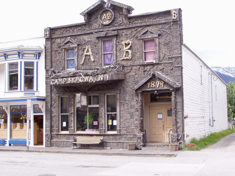
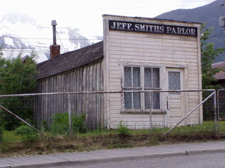
After a light dinner, we walked down to the Fraternal Order of Eagles hall for the 48th show of the 75th season of the musical "Days of '98" which commemorates the last day of 'Soapy' Smith's life (Alaska's longest running theater production dating back to 1929). Smith was the last of the big-time western bad men. He and his gang of 200 gamblers, swindlers and thugs controlled Skagway during 1897-98. He was killed in a shoot-out on one of the town's docks on July 8, 1898 just 4 days after he was the grand marshal of the town's 4th of July parade. We didn't know it but beginning an hour before the play, Jeff Smith's Parlor opened for business. Back in 1898, his 'parlor' was really a saloon and gambling hall. They give you $1000 of play money with which to gamble. In the 15 minutes left of the evening, my pot grew to $5,800! Oh, for such luck in Vegas or Reno! Day 43 (Sunday, 30 May): Low 40's, Overcast & Rainy. Just a slow day in Skagway, for us anyway. We drifted downtown around 10 am to find 3 cruise ships in the harbor and the streets thronged with tourists just off them. After a short walk through some of the shops we didn't visit yesterday and a quick lunch at the Bonanza Cafe, we came back to the RV to just relax and piddle around. Its a good afternoon for reading or napping. Too many people on the streets. We'll wait till later when they all go back to their boats.
Day 44 (Monday, 31 May): High 50's, Sunny.
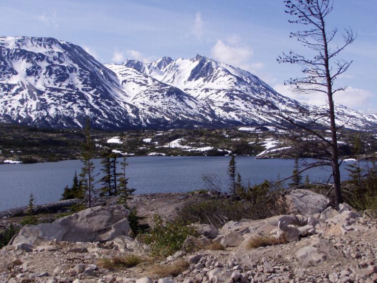
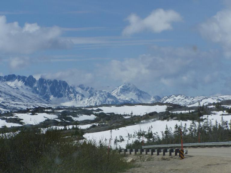
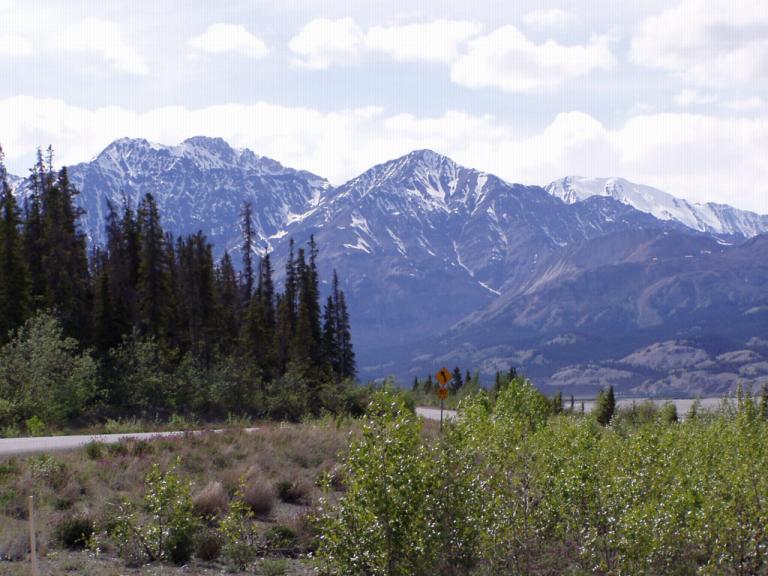
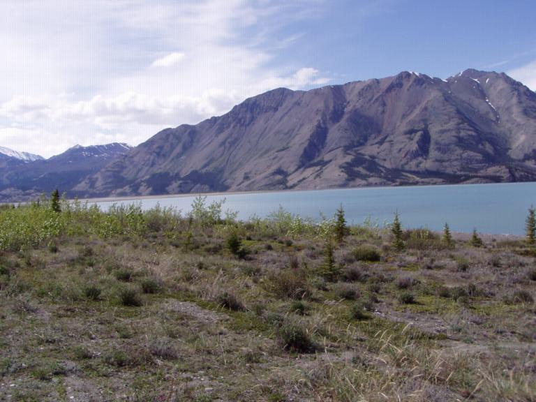
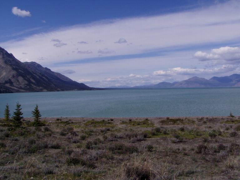
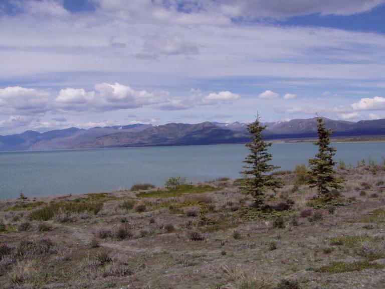
We also confirmed our Alaska Marine Highway ferry ride via the Inside Passage from Haines, AK to Prince Rupert, British Columbia, Canada, our mini-cruise on the way home. Actually, we'll spend Jerri's birthday on board! We have an outside cabin so even if there's bad weather, we can still enjoy the views; plus, we stop in Juneau, Sitka, Petersburg, Wrangle, and Ketchikan before arriving in Prince Rupert. And as the afternoon grew long, we loaded the RV onto the ferry for our 1-hour trip across the Ckilkat Inlet to Haines where we'll be for the next couple of days. Now, if you've never driven a 30' RV pulling an 18' car trailer onto one of Alaska's ferries, you've not lived! The first thing was driving down the gangplank. Then, after making a 90º turn onto the ferry, maneuvering into it and backing into a long parking space was, to say the least, interesting. But, with the crew's directions, we did okay. Then, we found a table in the dining room amidships and to the stern of the 480' ferry. The dining room was encased in glass on 3 sides so, as we ate dinner, we had a panoramic view of where the ferry had traveled. The Inside Passage is awesome! Jerri especially liked the views and is excited about our trip from Haines to Prince Rupert when we head home in a couple of months. About the time we were finishing our after dinner coffee, the ferry was beginning its approach to Haines. Getting off the ferry in Haines was, um, exciting. I had to drive forward and make a series of backing turns inside the ferry to head up the gangplank to Haines. And then we found what is probably the nicest RV park we've visited in Canada and Alaska, Haines Hook-UP RV Park. Day 45 (Tuesday, 1 June): High 50's, Morning Rain; Afternoon Sunny. Haines, Alaska - Across Canada to Alaska border (364 miles) Since we've decided to return to Haines at the end of our Alaska visit to take the Inside Passage ferry to Prince Rupert, we decided to keep our exploration of Haines and a side trip to Juneau until then. So, after sleeping late, we headed for Tok, Alaska. I've gotta tell you, not only are the major gas companies ripping us off, so are the filling station owners. Example: I filled up in Haines at $2.579 per gallon. About a block down the road gas was $2.529 per gallon. Another 15 miles down the road, in the 'boonies' on the Alaska side of the US/Canadian border gas was $2.319 per gallon. Later in the afternoon, when we crossed the US/Canadian border again, in the 'boonies' 90 miles from Tok, gas was only $2.239 a gallon Why the disparity? The folks in Haines and up the road at the border all get their gas from the same place, it either comes in by boat from down south or over the Alaska Highway from up north (which means they all three get their gas from the same place as they al 3 were Tesora stations). So, why the 26¢ difference between Haines and the southern Canadian border and the 34¢ difference between Haines and the northern Canadian border (or the 8¢ difference at the border stations?)? I'm going to watch gas prices all over Alaska, but we're definitely being ripped off! And do you think gas prices will ever go down again now that they're up where they are? Like a Canadian gas station operator told me, "Its about time you Yanks were paying the proper price for petrol!" The RV and MG were clean when we left Haines, Alaska and they were clean when we got to Haines Junction, Canada; but, when we stopped for the night outside Tok, Alaska, they were both filthy! The Haines Highway was a pretty good road; the Alaska Highway wasn't even a road most of the day. After crossing into Canada on the Haines Highway out of Haines, we climbed over the backbone of the St. Elias Mountains until we were above the tree line and in the permanent ice area of the Chilkat Pass (EL 3,493 ft). I mean, we were so high that the bushes were only a couple of feet high and scraggly. There were no animals anywhere on the Haines Highway today. And the wind blows constantly along that narrow ridge though the mountains. Remember, the White Pass out of Skagway and the Chilkat Pass were the only two ways to get over the mountains to the Klondike, the White Pass being the lower route. Well, we've now been over them both! Entering Canada, everything was ho-hum at 55 mph until we got to Kluane Lake. Kluane is the largest lake in the Yukon Territory and the road runs right along its southern and western shores. About halfway around the lake is sheep Mountain, one of the places I was looking forward to visiting again. I even brought 2 pair of binoculars so Jerri and I could both watch the sheep; today there weren't any to be seen. I think there were a couple of reasons for that: the lake has receded about 300' from the banks that we drove along in the '80's, and there was heavy road equipment everywhere. But, Kluane Lake is still the second prettiest lake on the Alaska Highway.
Along the southern shore of the lake, Canada has surveyed a new road route that's out in the muck and mire of the lake by about 50'. Then right past Sheep Mountain, the road disappears and we shared a dirt roadbed with graders, scrapers, rollers, water trucks, and all kinds of heavy equipment. One time we were driving on the right side and the next on the left because a piece of equipment was working where we had been. Somewhere near Destruction Bay on the northwest edge of the lake, the blacktop reappeared, for a few, short miles. However, from there to the Alaskan border the road - when it appeared - was full of ice heaves that kept our speed down to 30-or-so mph. To say the least, today's drive was a killer. And it ruined my miles per gallon average, all that slow, speed up, climb mountains, slow, speed up, man! But, we're in the main body of Alaska!
|