|
Into Canada |
Day 33 (Thursday, 20 May): High-60's, Sunny.
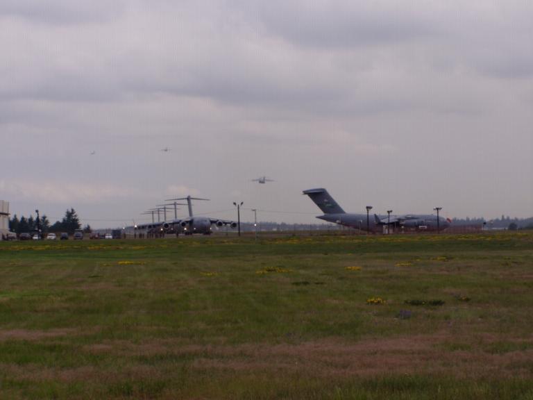
And the closer we got to Canada, the more the tug of Alaska gripped us. For those who watch the various Starship Enterprise television series, you all know what a 'tractor beam' is. Its when a larger spaceship locks onto a smaller one with a beam that pulls the smaller ship to the larger one. Alaska's 'tractor beam' is getting stronger and stronger today. We had intended to stop overnight in northern Washington, but the pull was too strong. We decided to go for Canada! All the horror stories of Canadian border crossings since the Mad Cow scare were just that, stories. We'd been told by people who've recently crossed into Canada that they had all lost their meat, eggs, and fresh fruit ("They even made us pick all the pieces of pepperoni off the pizza we had just bought for lunch." ), and that the border guards had torn their RV's apart looking for contraband. So, cautiously we pulled up to the Canadian border at Sumas, WA. What a goof that was. Once our RV was locked into a space barely wide enough for my car trailer and I'd handed our passports to the guard, the series of questions began: "Do you have any weapons, mace, pepper spray or fireworks with you?" "Do you own any of those products?" DUH! What I own back home is of no importance to them! "Do you have any alcohol products with you?" "More than $7,000CDN in cash or travelers checks?" Did they really think I was going to answer that one? "For where are you bound?" "How long will you be in Canada?"
"Where are you from?" And she walked back to the
rear of the RV to check the license, never looking at the Then, we were directed where to park and instructed to take our passports inside to the immigration officer ("No, I don't need to see your vehicle registrations or insurance cards." "No, they won't need them either - just your passports.") Inside, there was another series of questions: "When was the last time you were in Canada?" "Have either of you been convicted of any crime?" "For where are you bound?"
"How long will you be in Canada?" When I told them 2
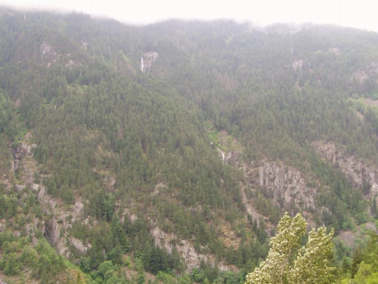
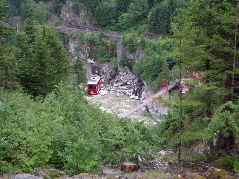
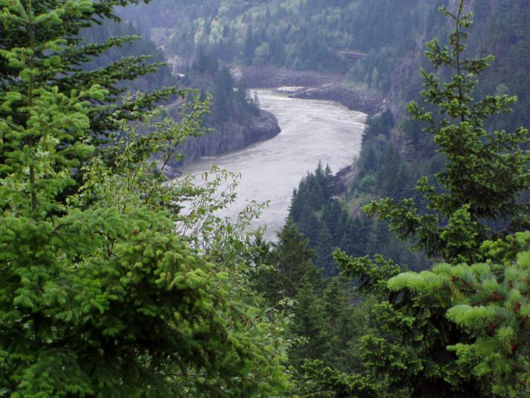
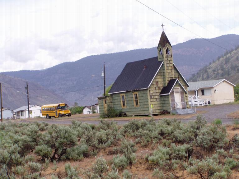
or 3 weeks, their next question was, "So, you're just "Are you sure you have enough money to get all the way to Alaska?" Not a word about the dozen eggs, the bacon and hamburger meat, the packages of homemade sausage or the oranges and lemons. So much for the Mad Cow scare! Once in Canada, we stopped in Chilliwack, British Columbia for the night. I'd not yet exchanged any cash so I had to accept the rate the RV park manager. He offered 72¢ to the dollar which made our cost for the night less than $20 - no big deal, I thought, that's cheaper than most anywhere in the US! Tomorrow, I'll go to the nearest bank and exchange some money at the real rate - it'll be lower, I'll bet! As he and I were talking, I asked him where he was from. "Canada," was his answer. "No, I meant originally." "Oh, the Phillipines." was his retort. "I've been there a couple of times, in and out, passing through." I answered. "Subic Bay? You must've been much younger then." he laughingly offered. Then, Jerri took her evening walk around the park and halfway through stopped back to inform me that we were the only 'foreigners' in the park! And right now, I'm watching the building of the ALCAN (Alaska-Canadian Highway) and the effects of America's involvement in WWII on TV - from Canada's viewpoint! Day 34 (Friday, 21 May): 50's, Overcast, Rain Showers. From this point northward, traveling is nothing like in the Lower 48. Did you notice how easily I slipped into the "Lower 48" jargon? Yep, the call of Alaska is even stronger today. From now on, we won't be using the typical roadmap. We're deep into our "Milepost" travel guide. And I have to use the little numbers inside my speedometer - the normal speed limit is 100 kph but I'm only driving about 90 kph. For those who've never traveled Canada and Alaska and don't know what the "Milepost" is, here's a brief overview. The "Milepost" is a thick book that provides mile-by-mile descriptions of every major highway and road in Alaska and northwestern Canada with detailed information on anything that might be along the way (attractions, gas stations, RV parks, cities and towns, unique points of interest, etc. that you might need to know about as you travel. Its laid out by highway logs so, for example, once you get on the West Access Loop (which we're currently on), you can just follow along as you travel based on mileposts. Here's a typical item: "A 77.5 (124.8 km) CC 92.5 (148.9) Alexandria Bridge Provincial Park, picnic areas and interpretive displays on both sides of highway. Hiking trail down to the old Alexandria Bridge, still intact. This suspension bridge was built in 1926, replacing the original built in 1863." I don't know of any visitors to this part of the world who don't have a Milepost in their car. We're currently using our 2003 edition but there's a new one out every year. And when things get few and far between, it'll come in handy to know just how far we are from the next gas station. Oh, a guy passed us today going more that 100 kph just as a Royal Canadian Mountee was passing in the opposite direction. The Mountie just flashed his lights to let the guy know to slow down. No big deal. No turning around in the middle of the road to chase him down. Just a quick flash of the lights to say "slow it down." Another admin note: Don't believe everything Verizon tells you; heck, I'm almost ready to say don't believe anything they tell you! When we crossed the border yesterday, it was like a big electronic wall was surrounding the US. Our phone went directly to continual roam. When I initially changed to Verizon, they told me a feature named "Call Canada" was available for $10 per month without affecting my current calling plan, which I like. WRONG! When I called them to set it up, "Call Canada" would cost me $45 a month and completely change my plan! So, we bought calling cards to make calls back to the Lower 48 and to our friends in Canada. Now, my internet access is limited to what I can find at RV parks and city libraries - at least until we get to Alaska (but, I'll probably find that Verizon doesn't work there either!) Now, for our day's activities: Chilliwack, BC - Cache Creek, BC: Today, we drove Canadian Highway 1 through Fraser Canyon with the river alternating sides, one moment on our left, the next on our right; one moment level with us, the next hundreds of feet below us. Awesome, unbelievable, amazing were just some of the superlatives we used to describe the scenery around each bend. From craggily rocks covered intermittently with evergreens to solid green mountains that reached from the edge of the road to the clouds to a point where there were no trees but the mountains still reached to the clouds, we were constantly in awe at the beauty that surrounded us. Everything we've seen so far pales before this drive! (But, then, Ill probably say that several more times before we get home!) What's amazing is that man could build the roads and railways over/through this canyon. Man! There was one time e rounded a curve and came upon a setting that looked like it was on some hobbyists railroad layout. Down below Oh, pullovers. They're spaced out pretty good so that slower rigs can pull over to let traffic pass. But you don't pull over anywhere else as its a straight drop off to one side. Rails? Occasionally but not often. They block the view! Kidding, I don't know why there aren't any, they're just not there.
Like I said, the farther north we get, the stronger is Alaska's tug. Guess its sort of like the ring around Frodo's neck; the closer he got to the fiery lake from which it was cast, the stronger was its control over him. I almost didn't want to stop for the night; but I needed to call a friend over in Kamloops, BC, and Jerri wanted to call our niece in Marietta, GA to wish her a happy high school graduation tomorrow. Oh yeah, my money changing experience this morning? I went to a bank who sent me to Canada Trust, the band with the green sign. They exchange money with no charge! The US dollar is worth $1.35 Canadian dollars so the guy at the RV place last night was pretty close on his exchange rate. We also stopped by a Safeway to pick up a few groceries. They gave us a card that reduced our bill by $9.96CDN - so, groceries were about the same as the US with it! Tonight's RV park rent is $25CDN which is about $18.50US. So, last night's $20US was really $27CDN which was within a few cents of the printed bill! Man, I'm gonna go crazy converting the cost of things! Day 35 (Saturday, 22 May): AM High 40's; PM 50's, Overcast, Morning Rain Showers. One thing you don't want to do in Canada or Alaska is run out of gas. Do so and you might find you're 50 miles from the nearest gas station - in either direction! Plus, you can drive all day and not see another car so, if you're on the side of the road, you're on the side of the road! Of course, my insurance company will have gas brought out to me but if I'm 50 miles from a filling station, that's probably the same as 2 hours on the side of the road by the time a local wrecker/repair facility gets the call. So, I've planned to always fill up when my gauge reads 1/2. The second thing you don't want to do in Canada is buy gas! But, you have to. Canada is on the European metric system and so sells their gas by the liter. There are 3.8 liters to a US gallon; thus, I have to convert to figure out how much gas I'm buying. I didn't do a good job of that today when I bought gas and could've put another 10 gallons in my tank. Oh well. But, here's the real reason you don't want to buy gas in Canada: the gas I bought today was $0.969CDN per liter - that's $3.58CDN per gallon or $2.66US per gallon. The highest we've paid on the entire trip! Another new thing today was road mileage signs. Just like the speed limit signs, they're written in kilometers Figuring the speed limit's easy: I just use the inside row of numbers on my speedometer. Kilometers to mileage isn't, I've got to mentally convert to know how far to the next town. Thus, when we were 435 km from Prince George we were really only about 287 miles since the conversion factor is (I think) multiplying kilometers by .62. So, a US dollar equals 1.35 Canadian dollars, there are 3.8.7 liters to a gallon and .66 miles to a kilometer; all that math in my head. Plus, how hot is it when its 15ºC (Celsius x 1.8 + 32?)? Where's Matt Dean when I need him? Well, him or one of his Scholar Bowl kids! Cache Creek, BC - Prince George, BC (Caribou Highway) Today was a long day so we got an early start. Our goal was to reach Prince George because from there to Dawson Creek, the start of the Alaska Highway, lays 250 miles of nothingness! We did it, with time to spare! See, that's something else you've gotta do when traveling the northern part of Canada or Alaska, plan the next day's drive. Had we not made Prince George today, tomorrow night we would've had to pull over on the side of the road for the night because we couldn't make Dawson Creek. And Jerri's not yet comfortable doing that. We're also getting up into the part of Canada where roads have numbers and names. Today we traveled the Caribou Highway (Canada 97) which tomorrow keeps its same number but becomes the John Hart Highway. The scenery was nice but not spectacular. We were primarily traveling through timber land or farming areas. We did get to a point where there were as many White Birch trees as evergreens.
Oh, Jerri's getting pretty good at navigating via the "Milepost". She's gotten to where she knows what lies ahead and about how far till we get there (though she multiplies kilometers by .6 so is always a bit short). She's also getting pretty good at recognizing points of interest that we'd like to stop to see. he reads their description before we get there so we can either stop of cruise by. Makes the drive more interesting!
Day 36 (Sunday, 23 May): 50's, Sunny. Prince George, BC - Dawson Creek, BC (John Hart Highway) The word for today's drive is easy: wilderness! Because, with little exception, that's all we saw. Not many other travelers and very few towns. Just us, the scenery, and the animals. All in all, it was an easy drive. For the most part I just set the cruise control on 55 and enjoyed the scenery. Throughout the morning it was fir forests with a few birch and lots of lakes. I mean, there was constant water on one side of us or the other; little lakes, big lakes and streams and rivers connecting them. And there were always beaver dams. As I drove along looking at them, it reminded me of a word identification and comprehension test we gave to students as part of the Alabama Reading Initiative. On the test was an expository composition about beaver dams that required the student to answer questions about what s/he had read. I'd given that test so many times that I'd begun to hate beaver dams. Not after today. They're pretty ingenious engineering feats. We even passed one where the beavers had first made a lake by building a huge round dam; and then they built their home in the middle of their 'beaver-made' lake!
After lunch, everything changed once again. We started our ascent into the Canadian Rockies. Back in the "Lower 48", we'd crossed the Rockies from the east to the west. Today we crossed them from the west to the east. And, in my opinion, they're prettier here in Canada. Jerri said they reminded her of the Grand Tetons.
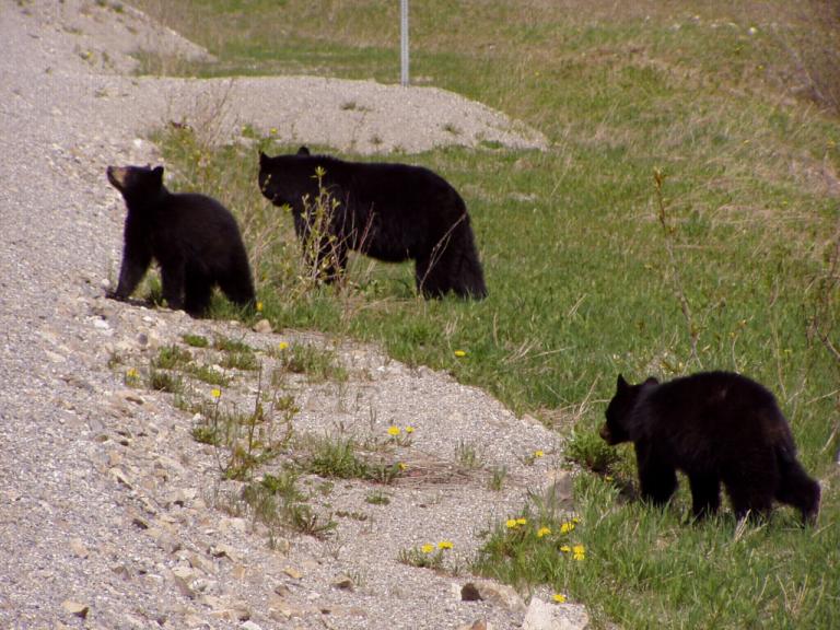
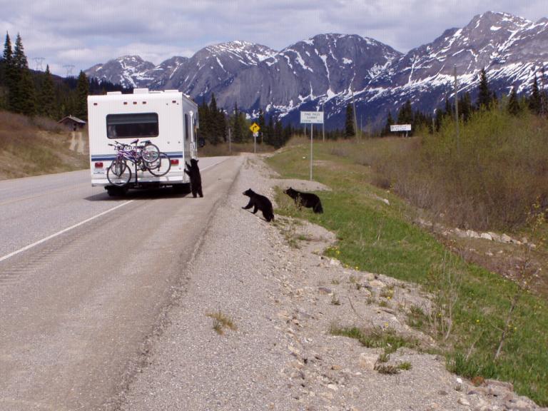
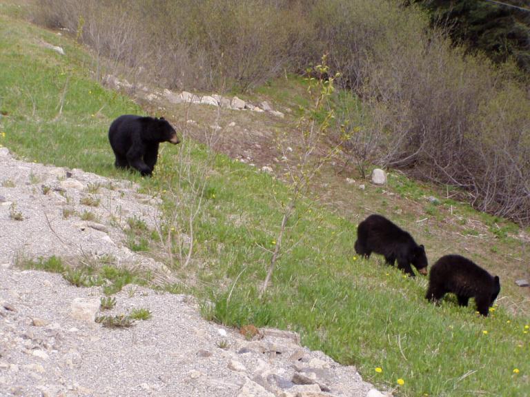
Earlier in the day we had come upon a black bear, a moose, a beaver, and lots of Canadian Geese; however, as we were climbing up into the Rockies, we came around a bend and there was an RV stopped in the road. Wondering what was the deal, we pulled in behind it. Then we saw them! A mother black bear and her cubs. They were out for a Sunday afternoon stroll eating the yellow flowers off the dandelions along the side of the road.
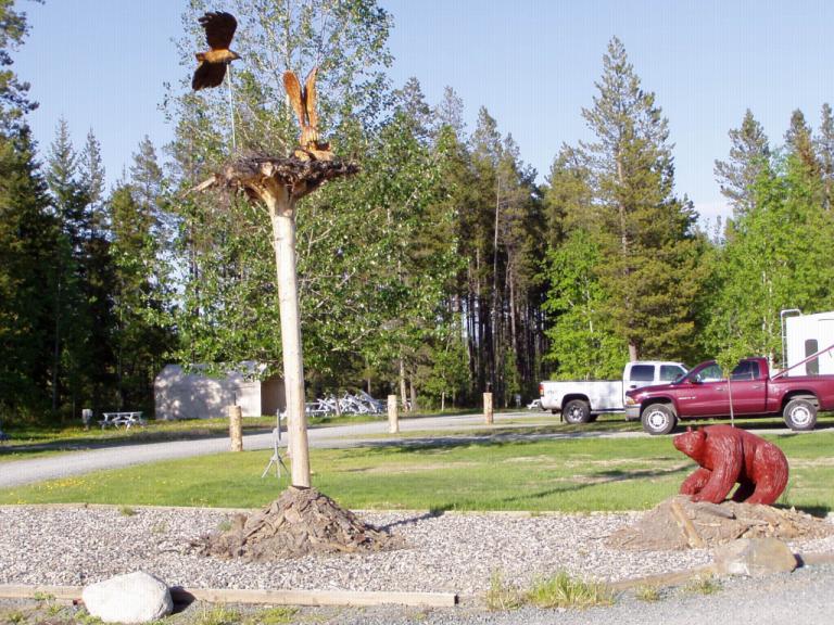
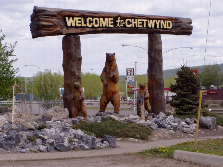
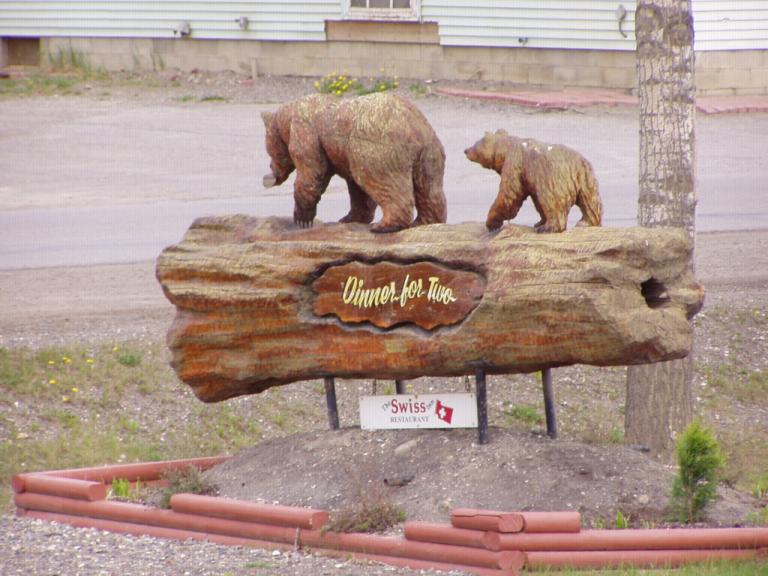
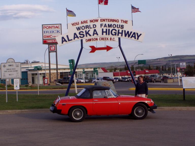
After we crossed the Rockies, everything changed again. There were no more fir trees (well, maybe a few). All we drove through for the rest of the day was forest after forest of birches, and they were much smaller than earlier in the day. Of course, we were also at a higher altitude. Finally, we came into the town Chetwynd, the "Chain Saw Sculpture Capital of the World" where there are over 45 sculptures strewn about though out the town.
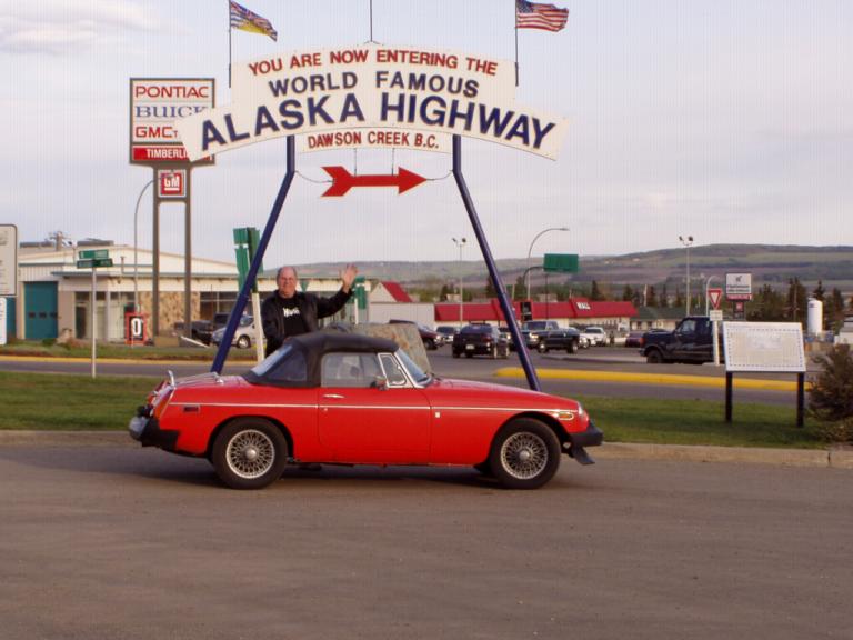
But, what did I like the most about Chetwynd? "A&W Root Beer's got that frosty mug taste." They still serve root bear in a frosty glass mug! Man! It tasted just like when I was a kid. No plastic mugs that are cooled in water like in Huntsville. Real glass mugs that had frost all over them! Hmmmm! Well, I guess we're officially at the end of the map! If you look at the map of British Columbia in a Rand & McNally atlas, you'll see that it ends at Dawson Creek/Fort St. john. There's no map of northern BC, the Yukon or the Northwest Territories. Once we launch from here on Tuesday morning, we're solely at the mercy of our "Milepost". Day 37 (Monday, 24 May): High 60's, Sunny. Dawson Creek, BC I awoke this morning thinking it was way too early for the day to be beginning. Looking at the clock, I realized it was only 3:45 am, but the sun was already coming up. Yep, we're in the northern land, the land of eternal sunlight or eternal darkness. Right now, its in a transition period. The sun is peeking its head out from about 3:45 am until 10:30 pm. So, there's about 19 hours of some type sunlight, be it full sun, dusk or dawn. Nope! Back to bed! We've got to get accustomed to the sun again as, by the time we reach Alaska, we'll have about 20 hours of full sunlight every day! Yesterday, some of the guys in the RV park warned me that the night before we arrived, the temperature had dropped to 27º - our 27, not Canada's - and that their water hoses connecting their RV's to the park's water system had frozen. So, before we went to bed, I set our furnace for 65º in the event it got so cold that the electric heat couldn't handle it. Nothing, thank goodness! The temperature through the evening and night was mild; and we awoke to a sunny, warm day that got up to 68º. A perfect day for exploring Dawson Creek. However, today is Victoria Day in Canada, the day they celebrate the birthday of Queen Victoria. Its a national holiday akin to our Memorial Day as it marks the beginning of the summer vacation season. Almost nothing was open! The visitor's center was, and it had a neat museum where we watched a long film on the construction of the Alaska highway.
|
||||||||||||||||||||||||||||||||||||||||||||||||||||||||||||